Wiler bei Utzenstorf
| Wiler bei Utzenstorf | ||
|---|---|---|
 |
||
|
||
| Coordinates: 47°9′N 7°33′E / 47.150°N 7.550°ECoordinates: 47°9′N 7°33′E / 47.150°N 7.550°E | ||
| Country | Switzerland | |
| Canton | Bern | |
| District | Emmental | |
| Area | ||
| • Total | 3.82 km2 (1.47 sq mi) | |
| Elevation | 462 m (1,516 ft) | |
| Population (Dec 2015) | ||
| • Total | 881 | |
| • Density | 230/km2 (600/sq mi) | |
| Postal code | 3428 | |
| SFOS number | 0554 | |
| Surrounded by | Bätterkinden, Utzenstorf, Zielebach | |
| Website |
www SFSO statistics |
|
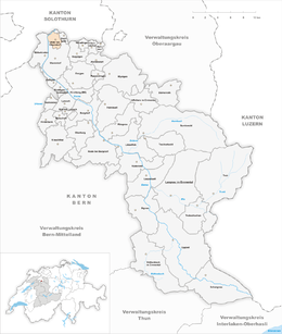
Wiler bei Utzenstorf is a municipality in the administrative district of Emmental in the canton of Bern in Switzerland.
Wiler bei Utzenstorf is first mentioned around 1261–63 as Wilere.
The village was first mentioned as a part of the Kyburg district of Utzenstorf. It was also part of the court and parish of Utzenstorf. In 1514, the entire district was acquired by the town of Bern. Under Bernese rule it became part of the bailiwick of Landshut in Utzenstorf. With the Act of Mediation in 1803, the old bailiwick was dissolved and Wiler became part of the new Fraubrunnen District.
In the 19th century many of the local farmers shifted from raising food crops to raising dairy cattle. A dairy farmers' cooperative was established in 1850 and in 1859 a local dairy was built. A new road from Burgdorf to Solothurn was built through the village in 1908. This was followed by a railroad station of the Solothurn-Burgdorf-Thun Railway in 1929. The improved roads and the railroad allowed factories to settle in Wiler. The village began to change from a rural, agricultural village into an industrial and commuter town.
The first village school, shared between Wiler and Zielebach, opened in 1728. In 2010, the schools of Wiler, Utzenstorf, Bätterkinden and Zielebach have joined together into the Untere Emme school district.
Wiler bei Utzenstorf has an area of 3.82 km2 (1.47 sq mi). Of this area, 2.02 km2 (0.78 sq mi) or 52.9% is used for agricultural purposes, while 1.16 km2 (0.45 sq mi) or 30.4% is forested. Of the rest of the land, 0.58 km2 (0.22 sq mi) or 15.2% is settled (buildings or roads), 0.04 km2 (9.9 acres) or 1.0% is either rivers or lakes.
...
Wikipedia


