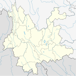
Yingjiang County
|
Yingjiang County 盈江县 |
|
|---|---|
| County | |
| Location in Yunnan | |
| Coordinates: 24°43′N 97°56′E / 24.717°N 97.933°ECoordinates: 24°43′N 97°56′E / 24.717°N 97.933°E | |
| Country | People's Republic of China |
| Province | Yunnan |
| Prefecture | Dehong |
| Area | |
| • Total | 4,429 km2 (1,710 sq mi) |
| Population (2003) | |
| • Total | 270,000 |
| • Density | 61/km2 (160/sq mi) |
| Postal code | 679300 |
| Area code(s) | 0692 |
| Website | www |
Yingjiang County (simplified Chinese: 盈江县; traditional Chinese: 盈江縣; pinyin: Yíngjiāng Xiàn) is a county in Dehong Prefecture, Yunnan province, China, bordering Burma's Kachin State to the west.
Yingjiang county has a border of 214.6 km (133.3 mi) with Kachin State, Myanmar in the west. The Danzha River (Chinese: 胆扎河; pinyin: Dănzhá Hé) and Binglang River (Chinese: 槟榔江; pinyin: Bīngláng Jiāng) meet near Jiucheng (Chinese: 舊城; pinyin: Jiùchéng) and become the Daying River (Dàyíngjiāng). The Daying then flows through Yingjiang County into Myanmar and into the Irrawaddy River, with the confluence near Bhamo. The Daying is known as the Taping (大平江; Dàpíng Jiāng) in Myanmar.
Yingjiang county is mountainous with several alluvial plains. The county has various climate types, with ranges from the tropical, the subtropical, to the temperate zones. Intact forests can be seen in the mountains above 2,000 m (6,600 ft). The elevations vary from 210 to 3,404.6 m (689 to 11,170 ft).
Yingjiang is abundant in hydroelectric, forest, and geothermal resources. There are 21 hot springs, 6 of which are above 90 °C (194 °F). Most of the hot springs are distributed within the Daying River system.
...
Wikipedia

