Wyoming County, New York
| Wyoming County, New York | ||
|---|---|---|

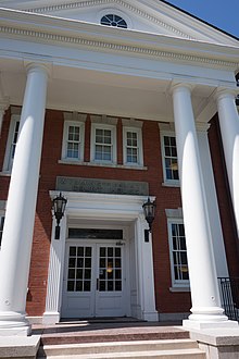
Wyoming County Courthouse
|
||
|
||
 Location in the U.S. state of New York |
||
 New York's location in the U.S. |
||
| Founded | 1841 | |
| Seat | Warsaw | |
| Largest town | Attica | |
| Area | ||
| • Total | 596 sq mi (1,544 km2) | |
| • Land | 593 sq mi (1,536 km2) | |
| • Water | 3.5 sq mi (9 km2), 0.6% | |
| Population | ||
| • (2010) | 42,155 | |
| • Density | 71/sq mi (27/km²) | |
| Congressional district | 27th | |
| Time zone | Eastern: UTC-5/-4 | |
| Website | www |
|
Wyoming County is a county in the U.S. state of New York in the state's western area. As of the 2010 census, the population was 42,155. The county seat is Warsaw. The name is from a modified Delaware Indian word meaning "broad bottom lands". Wyoming County was formed from Genesee County in 1841.
As with the rest of Western New York, Wyoming County was part of disputed territory throughout the 17th and 18th centuries, with Massachusetts Bay Colony, Connecticut Colony, Pennsylvania Colony, New York Colony, and (to a lesser extent) New France; New York's claims would not be recognized until the Treaty of Hartford was ratified in 1786 and would not be actively asserted until the Holland Purchase.
In regard to New York's claim, as of 1683 the present Wyoming County was part of Albany County. This was an enormous county, including the northern part of New York State as well as all of the present State of Vermont and, in theory, extending westward to the Pacific Ocean. This county was reduced in size on July 3, 1766, by the creation of Cumberland County, and further on March 16, 1770, by the creation of Gloucester County, both containing territory now in Vermont.
...
Wikipedia

