Wurmberg (Harz)
| Wurmberg | |
|---|---|

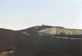
The Wurmberg with its ski jump
|
|
| Highest point | |
| Elevation | 971 m (3,186 ft) |
| Prominence | 182 m (597 ft) |
| Isolation | 3 kilometres (1.9 mi) |
| Parent peak | Brocken |
| Coordinates | 51°45′24″N 10°37′8″E / 51.75667°N 10.61889°ECoordinates: 51°45′24″N 10°37′8″E / 51.75667°N 10.61889°E |
| Geography | |
| Parent range | Harz |
At 971 m above sea level (NN) the Wurmberg is the second highest mountain in the Harz and the highest in Lower Saxony (Germany).
The Wurmberg lies north of Braunlage, in the district of Goslar, and west of Schierke. Its summit is located due south of the Brocken and roughly 400 m (as the crow flies) south of the state border with Saxony-Anhalt. The two mountains are separated by the valley of the Kalte Bode, which in this area is about 660 m above NN.
Until October 2006, the Wurmberg lay within the Upper Harz Nature Reserve (Naturschutzgebiet Oberharz). Since then only two areas totalling 183 hectares in area on the west and southwest slopes have been designated as the Wurmberg Nature Reserve.
On the southern flank of the Wurmberg there are two striking tors or Wurmbergklippen, which are one of the many Harzklippen:
On the topmost summit level of the crag there is a triangular offering cup (Opferschale or Zwergenmolle). Many legends, mostly about the "Wild Hunter" (Wilden Jäger) surround this artificially chiselled out rectangular hollow. The Wild Hunter usually epitomises the god Wodin (or Thor) in Germanic mythology.
The named Wormberch had already surfaced by the 13th century in the documents and commodity schedules of the County of Regenstein-Blankenburg in connexion with the mining of iron ore. In the 19th century the mountain was still being called Wormsberg or Wormberg, but a convincing derivation of the name has yet to be found.
...
Wikipedia

