Winters, CA
| City of Winters | |
|---|---|
| City | |

Downtown Winters
|
|
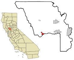
 Location in Yolo County and the state of California |
|
| Location in the United States | |
| Coordinates: 38°31′30″N 121°58′15″W / 38.52500°N 121.97083°WCoordinates: 38°31′30″N 121°58′15″W / 38.52500°N 121.97083°W | |
| Country |
|
| State |
|
| County | Yolo |
| Incorporated | February 9, 1898 |
| Government | |
| • Mayor | Wade Cowan |
| • State senator | Bill Dodd (D) |
| • Assemblymember | Cecilia Aguiar-Curry (D) |
| • U. S. rep. | John Garamendi (D) |
| Area | |
| • Total | 2.96 sq mi (7.67 km2) |
| • Land | 2.94 sq mi (7.60 km2) |
| • Water | 0.03 sq mi (0.06 km2) 0.85% |
| Elevation | 135 ft (41 m) |
| Population (2010) | |
| • Total | 6,624 |
| • Estimate (2016) | 7,144 |
| • Density | 2,434.07/sq mi (939.86/km2) |
| Time zone | Pacific (UTC−8) |
| • Summer (DST) | PDT (UTC−7) |
| ZIP code | 95694 |
| Area code | 530 |
| FIPS code | 06-86034 |
| GNIS feature IDs | 1652656, 2412288 |
| Website | www |
Winters is a city in rural Yolo County and the western Sacramento Valley, in northern California.
The estimated population of Winters was 7,034 as of July 2015. It is part of the Sacramento–Arden-Arcade–Yuba City, CA-NV Combined Statistical Area.
Winters is a small city located on Putah Creek in the western Sacramento Valley, near the northeastern Vaca Mountains foothills.
It is located on along Interstate 505, 11 miles (18 km) from Vacaville. Winters is nearly 30 miles (50 km) from Sacramento and about 60 miles (100 km) from San Francisco, California. It is located at 38°31′30″N 121°58′15″W / 38.52500°N 121.97083°W,
According to the United States Census Bureau, the city has a total area of 2.9 square miles (7.5 km2), of which, 2.9 square miles (7.5 km2) of it is land and 0.03 square miles (0.078 km2) of it (0.85%) is water.
John Reid Wolfskill, a Kentucky immigrant to Mexican Alta California, received a Mexican land grant for Rancho Rio de los Putos in 1842 by Governor Juan Bautista Alvarado. His brother, John Reid Wolfskill, started the agricultural development of the Sacramento Valley by planting orchards and vineyards on his lands. In 1849, William Wolfskill transferred half of Rancho Rio de los Putos to John Wolfskill, and transferred the rest to his brother in 1854.
...
Wikipedia

