Yolo County, California
| Yolo County, California | |||||||
|---|---|---|---|---|---|---|---|
| County | |||||||
| County of Yolo | |||||||
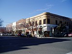
Images, from top down, left to right: The former Yolo County Courthouse in Woodland, The Ziggurat in West Sacramento, Mondavi Center on the UC Davis campus, Downtown Winters, Canada Geese at the Yolo Bypass Wildlife Area
|
|||||||
|
|||||||
 Location in the state of California |
|||||||
 California's location in the United States |
|||||||
| Coordinates: 38°33′14″N 121°44′17″W / 38.55389°N 121.73806°WCoordinates: 38°33′14″N 121°44′17″W / 38.55389°N 121.73806°W | |||||||
| Country | United States | ||||||
| State | California | ||||||
| Region | Sacramento Valley | ||||||
| CSA | Greater Sacramento | ||||||
| Incorporated | February 18, 1850 | ||||||
| County seat | Woodland | ||||||
| Largest city |
Davis (population) West Sacramento (area) |
||||||
| Area | |||||||
| • Total | 1,024 sq mi (2,650 km2) | ||||||
| • Land | 1,015 sq mi (2,630 km2) | ||||||
| • Water | 8.9 sq mi (23 km2) | ||||||
| Highest elevation | 3,123 ft (952 m) | ||||||
| Population (April 1, 2010) | |||||||
| • Total | 200,849 | ||||||
| • Estimate (2015) | 213,016 | ||||||
| • Density | 200/sq mi (76/km2) | ||||||
| Time zone | Pacific Time Zone (UTC-8) | ||||||
| • Summer (DST) | Pacific Daylight Time (UTC-7) | ||||||
| Area codes | 530, 916 | ||||||
| FIPS code | 06-113 | ||||||
| GNIS feature ID | 277321 | ||||||
| Website | www |
||||||
Yolo County, officially the County of Yolo, is a county located in the northern portion of the U.S. state of California. As of the 2010 census, the population was 200,849. Its county seat is Woodland.
Yolo County is included in the Sacramento-Roseville-Arden-Arcade, CA Metropolitan Statistical Area. The county is located in the Sacramento Valley.
Much of Yolo County remains a relatively rural agricultural region. This is evidenced by the multibillion-dollar state of California tomato industry that accounts for 90% of the canned and processed tomato production in the United States and 35% worldwide, to which Yolo County is a major contributor.
In the original act of 1850 the name was spelled "Yola." Yolo is a Native American name variously believed to be a corruption of a tribal name Yo-loy meaning "a place abounding in rushes" or of the name of the chief, Yodo, or of the village of Yodoi.
Yolo County was one of the original counties of California, created in 1850 at the time of statehood.
The county is governed by a board of five district supervisors as well as the governments of its four incorporated cities: Davis, West Sacramento, Winters, and Woodland.
According to the U.S. Census Bureau, the county has a total area of 1,024 square miles (2,650 km2), of which 1,015 square miles (2,630 km2) is land and 8.9 square miles (23 km2) (0.9%) is water.
...
Wikipedia


