Whitworth, Lancashire
| Whitworth | |
|---|---|
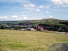
 A view over Whitworth, to Brown Wardle Hill |
|
| Whitworth shown within Lancashire | |
| Population | 7,500 (2011 Census) |
| OS grid reference | SD882185 |
| Civil parish |
|
| District | |
| Shire county | |
| Region | |
| Country | England |
| Sovereign state | United Kingdom |
| Post town | ROCHDALE |
| Postcode district | OL12 |
| Dialling code | 01706 |
| Police | Lancashire |
| Fire | Lancashire |
| Ambulance | North West |
| EU Parliament | North West England |
| UK Parliament | |
Whitworth is a small town and civil parish in Lancashire, England, amongst the foothills of the Pennines between Bacup, to the north, and Rochdale, to the south. It had a population of 7,500 at the 2011 Census.
Whitworth spans the Whitworth Valley, a 7 square miles (18.1 km2) area consisting of Healey, Broadley, Whitworth, Facit and Shawforth, linked by the A671 road. Several smaller hamlets are now part of Whitworth, such as Cowm Top, which was removed to make way for Cowm Reservoir.
Whitworth is twinned with Kandel, Germany.
The early history of Whitworth is unclear; exact dates are difficult to pin down. At the very earliest period, Whitworth was at the edge of the famed and extensive Forest of Rossendale, which covered 22,000 acres (89 km²) and reached a point somewhere near Bacup. Flint arrows, stone hammers and spearheads found in the area point to the existence of Mesolithic man who roamed the bleak open moors. Whitworth has a substantial history, notably the Whitworth Doctors who occupied Whitworth House, a property still in existence in Whitworth Square.
In those early years, Whitworth came within the ancient parish of Rochdale which, although vast, was itself a part of the hundred of Salford, one of the main divisions into which the historic county boundaries of Lancashire were divided during Norman times. The Abbot of Whalley Abbey held much of the land in this area. Saxton’s Map of Lancashire of 1577 does mark Whitworth, setting it between neat pyramid-like hills on either hand.
The 16th century saw the beginnings of sheep farming, the growth of weaving and eventually the first industry in the area, with coal mining being recorded in the 17th century Industrialisation, however, remained a "household" affair through the 18th century and the settlements of Whitworth, Facit and Shawforth remained villages. Impetus was given to the development of the area through the construction, during the middle of the century, of a turnpike road through the valley. It ran from Manchester via Rochdale and Whitworth to Bacup and then on to Burnley, Colne and Skipton. It was one of the few such roads in East Lancashire and provided a ready means of conveying local goods to Manchester and Yorkshire. The road was of vital importance in Whitworth’s industrial expansion and with it, the settlements in the township thus began to grow. By the 19th century, quarrying and coal mining were the chief industries although the manufacture of yarn remained important.
...
Wikipedia

