Westchester, IL
| Westchester, Illinois | |
| Village of Westchester | |
| Village | |
| Country | United States |
|---|---|
| State | Illinois |
| County | Cook |
| Coordinates | 41°51′14″N 87°53′1″W / 41.85389°N 87.88361°WCoordinates: 41°51′14″N 87°53′1″W / 41.85389°N 87.88361°W |
| Area | 3.69 sq mi (10 km2) |
| - land | 3.69 sq mi (10 km2) |
| - water | 0.00 sq mi (0 km2) |
| Population | 16,718 (2010) |
| Density | 4,530.6/sq mi (1,749/km2) |
| Founded | 1926 |
| Government | Village |
| Mayor | Sam D. Pulia is the current Village President |
| Timezone | CST (UTC-6) |
| - summer (DST) | CDT (UTC-5) |
| Postal code | 60154 |
| Area code | 708 |
|
Location in Cook County and the state of Illinois.
|
|
|
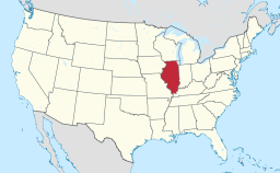
Location of Illinois in the United States
|
|
|
Website: www |
|
Westchester is a village in Cook County, Illinois, United States. It is a western suburb of Chicago. The population was 16,718 at the 2010 census. The current Village President is Sam D. Pulia.
The area now known as Westchester was occupied by German farmers dating back to the mid-19th century. Samuel Insull purchased the land in 1924 with plans to recreate an English-style town. As a result, the town's name and the majority of its street names are of English origin.
The Great Depression slowed construction in the ensuing decade, although the population continued to grow, largely aided by the presence of the western terminal of Chicago's rapid transit line. The extension of the line was removed in 1951. However, the Interstate Highway System's creation in 1956 led to the construction of nearby expressways I-290 and I-294, providing residents with convenient travel.
Expansion has consumed nearly all open land within the village, save for the 85-acre (340,000 m2) Wolf Road Prairie. It is the largest black-soil prairie remnant east of the Mississippi River.
Westchester is located at 41°51′14″N 87°53′1″W / 41.85389°N 87.88361°W (41.853890, -87.883712).
According to the 2010 census, Westchester has a total area of 3.69 square miles (9.56 km2), all land.
...
Wikipedia


