Werrikimbe National Park
|
Werrikimbe National Park New South Wales |
|
|---|---|
|
IUCN category Ib (wilderness area)
|
|

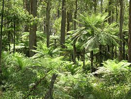
Tree ferns in Werrikimbe National Park
|
|
| Nearest town or city | Walcha |
| Coordinates | 31°12′S 152°14′E / 31.200°S 152.233°ECoordinates: 31°12′S 152°14′E / 31.200°S 152.233°E |
| Established | 11 July 1975 |
| Area | 333 km2 (128.6 sq mi) |
| Managing authorities | NSW National Parks & Wildlife Service |
| Website | Werrikimbe National Park |
| See also | Protected areas of New South Wales |
The Werrikimbe National Park is a protected national park located in the catchment zone of the Upper Hastings River in New South Wales, Australia. Gazetted in 1975, the 33,309-hectare (82,310-acre) park is situated approximately 486 kilometres (302 mi) north of Sydney and 65 kilometres (40 mi) from Wauchope, and 90 kilometres (56 mi) east of Walcha on the eastern escarpment of the Great Dividing Range.
The park is part of the Hastings-Macleay group World Heritage Site Gondwana Rainforests of Australia inscribed in 1986 and added to the Australian National Heritage List in 2007.
Werrikimbe Park is noted for a rich diversity of plants and animals, rainforest, extensive wilderness, scenic wild rivers and opportunities for outdoor recreation in a remote location. This national park contains an Aboriginal stone arrangement of two stone rings, bora rings, where initiation ceremonies were held.
All access roads to the park have a gravel surface, winding and steep in places. These roads are unsuitable for caravans. Beyond the Mooraback Road there is a four-wheel drive (4WD) trail to Youdales Hut visitor area which is only accessible by a 4WD with low range, after obtaining a key for the locked gate from either the National Parks and Wildlife Service or Apsley Motors in Walcha. There are five visitor areas with basic facilities — three on the eastern side near the edge of the escarpment, and two on the west, on the plateau.
...
Wikipedia

