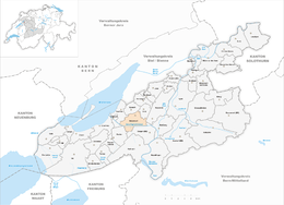
Walperswil
| Walperswil | ||
|---|---|---|
 |
||
|
||
| Coordinates: 47°4′N 7°14′E / 47.067°N 7.233°ECoordinates: 47°4′N 7°14′E / 47.067°N 7.233°E | ||
| Country | Switzerland | |
| Canton | Bern | |
| District | Seeland | |
| Area | ||
| • Total | 6.96 km2 (2.69 sq mi) | |
| Elevation | 468 m (1,535 ft) | |
| Population (Dec 2015) | ||
| • Total | 999 | |
| • Density | 140/km2 (370/sq mi) | |
| Postal code | 3272 | |
| SFOS number | 0754 | |
| Surrounded by | Bargen, Bühl, Epsach, Hagneck, Kappelen, Siselen, Täuffelen | |
| Website |
www SFSO statistics |
|
Walperswil is a municipality in the Seeland administrative district in the canton of Bern in Switzerland.
Walperswil is first mentioned in 1225 as Walperssuivile. In 1247 it was mentioned as Walbervilar.
The oldest trace of a settlement in the area is the old Grosses Moos Roman road which runs through the municipality. During the Middle Ages the village was owned by the Freiherr von Walperswil. In 1247, it was acquired by the Counts of Neuchâtel-Nidau. In 1398, the entire Inselgau, including Walperswil, was acquired by the city of Bern. The Jura water correction projects of 1868 to 1890 helped drain some of the marshes around Walperswil and opened up some farm land. In 1925-37 and 1966–78, additional drainage projects opened more farm land around the village. Today, much of the arable land in the municipality is used to raise strawberries. About two-thirds of the working population commute to nearby cities and towns for work.
The village church of St. Andreas, St. Margareth and St. Petronella was first mentioned in 1228. However, the first church on that site was probably built in the 9th century. The 13th century church was rebuilt in the second half of the 15th century. In 1528, Bern adopted the new faith of the Protestant Reformation and Walperswil converted with the rest of Bern's lands. Walperswil and the neighboring village of Bühl form a parish.
Walperswil has an area of 6.96 km2 (2.69 sq mi). As of 2012, a total of 5.37 km2 (2.07 sq mi) or 77.2% is used for agricultural purposes, while 0.54 km2 (0.21 sq mi) or 7.8% is forested. The rest of the municipality is 0.67 km2 (0.26 sq mi) or 9.6% is settled (buildings or roads), 0.41 km2 (0.16 sq mi) or 5.9% is either rivers or lakes.
...
Wikipedia


