Siselen
| Siselen | ||
|---|---|---|

Siselen village Reformed church
|
||
|
||
| Coordinates: 47°1′N 7°11′E / 47.017°N 7.183°ECoordinates: 47°1′N 7°11′E / 47.017°N 7.183°E | ||
| Country | Switzerland | |
| Canton | Bern | |
| District | Seeland | |
| Area | ||
| • Total | 5.52 km2 (2.13 sq mi) | |
| Elevation | 460 m (1,510 ft) | |
| Population (Dec 2015) | ||
| • Total | 579 | |
| • Density | 100/km2 (270/sq mi) | |
| Postal code | 2577 | |
| SFOS number | 0499 | |
| Surrounded by | Bargen, Finsterhennen, Hagneck, Kallnach, Lüscherz, Walperswil | |
| Website |
www SFSO statistics |
|
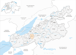
Siselen is a municipality in the Seeland administrative district in the canton of Bern in Switzerland.
Siselen is first mentioned about 1160 as Sisilli.
The oldest trace of a settlement in the area are scattered, individual items from the Bronze Age and a Hallstatt grave. During the Middle Ages, the village and the patronage rights over the village church were owned by the Counts of Neuchâtel-Nidau. In 1388 the village was acquired by Bern and became part of the Bernese bailiwick of Nidau. In 1803 it was transferred, against the villagers will, to the Erlach District.
The village church was first mentioned in 1225. The current church of St. Silvester was built in 1500 and rebuilt or renovated several times between the 17th and 20th centuries.
The village grew up along the Ins-Aarberg road. In addition to crops, the villagers tended vineyards. In 1516 they received the right to charge tolls on the Ins-Aarberg road and to use the tolls to maintain the road. A village charter was first written in 1736. The Jura water correction project of 1874 drained the marshy Grosses Moos and allowed farming of the rich soil. However, rising water levels required a second water correction project in 1970-87. The Biel-Täuffelen-Ins railroad built a station in the village in 1916. The village has remained generally agrarian, with, in 2005, nearly half of all jobs in agriculture.
Siselen has an area of 5.52 km2 (2.13 sq mi). Of this area, 4.08 km2 (1.58 sq mi) or 73.9% is used for agricultural purposes, while 1.03 km2 (0.40 sq mi) or 18.7% is forested. Of the rest of the land, 0.39 km2 (0.15 sq mi) or 7.1% is settled (buildings or roads), 0.01 km2 (2.5 acres) or 0.2% is either rivers or lakes and 0.02 km2 (4.9 acres) or 0.4% is unproductive land.
...
Wikipedia


