Wakhjir Pass
| Wakhjir Pass | |
|---|---|

Photo of the valley before the pass by Aurel Stein
|
|
| Elevation | 4,923 m (16,152 ft) |
| Traversed by | Pamir Mountains |
| Location |
Badakhshan Province, Afghanistan Xinjiang, China |
| Range | Pamirs |
| Coordinates | 37°05′14″N 74°29′03″E / 37.08722°N 74.48417°ECoordinates: 37°05′14″N 74°29′03″E / 37.08722°N 74.48417°E |
|
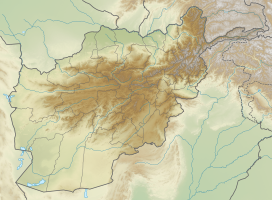
Location in Afghanistan
|
|
| Wakhjir Pass | |||||||||
| Chinese name | |||||||||
|---|---|---|---|---|---|---|---|---|---|
| Traditional Chinese | 瓦根基達坂 | ||||||||
| Simplified Chinese | 瓦根基达坂 | ||||||||
|
|||||||||
| Alternative Chinese name | |||||||||
| Traditional Chinese | 瓦赫吉爾山口 | ||||||||
| Simplified Chinese | 瓦赫吉尔山口 | ||||||||
|
|||||||||
| Pashto name | |||||||||
| Pashto | کوتل وجیر (Kōtal-e Vakhjīr) | ||||||||
| Transcriptions | |
|---|---|
| Standard Mandarin | |
| Hanyu Pinyin | wǎgēnjī dábǎn |
| Transcriptions | |
|---|---|
| Standard Mandarin | |
| Hanyu Pinyin | wǎhèjí'ěr shānkǒu |
| Wade–Giles | wa3-ho4-chi2-erh3 shan1-K'ou3 |
Badakhshan Province, Afghanistan
The Wakhjir Pass, also spelled Vakhjir Pass, is a mountain pass in the Hindu Kush or Pamirs at the eastern end of the Wakhan Corridor, the only pass between Afghanistan and China. It links Wakhan in Afghanistan with the Tashkurgan Tajik Autonomous County in Xinjiang, China, at an altitude of 4,923 metres (16,152 ft), but the pass is not an official border crossing point. The border has the sharpest official change of clocks of any international frontier (UTC+4:30 in Afghanistan to UTC+8, in China). China refers to the pass as South Wakhjir Pass (Chinese: 南瓦根基达坂), as there is a northern pass on the Chinese side.
There is no road across the pass. On the Chinese side, the immediate region is only accessible to military personnel. A 92 kilometres (57 mi)- long barbed wire fence was erected on the border, and there is a Chinese border guard outpost at Keketuluke just 20 kilometres (12 mi) east of the pass. In the summer of 2009, the Chinese Ministry of National Defense began construction of a new road to within 10 kilometres (6.2 mi) of the border for use by border guards. The road leads through the Taghdumbash Pamir to the Karakoram Highway 80 kilometres (50 mi) away. The entire valley to the east of Wakhjir Pass on the Chinese side is closed to visitors; however, local residents and herders from the area are permitted access.
On the Afghan side, the nearest road is a rough road to Sarhad-e Wakhan (also known as Sarhad-e Broghil), about 100 kilometres (62 mi) from the pass by paths. Just below the pass on the Afghan side is an ice cave, at an altitude of 4,554 metres (14,941 ft). This is the source of the Wakhjir River, which ultimately flows to the Amu Darya (Oxus). The cave is therefore claimed as a source of the Amu Darya. Dilisang Pass, to Pakistan, is in the same valley about 20 kilometres (12 mi) away.
...
Wikipedia

