Wadsworth, Ohio
| Wadsworth, Ohio | |
|---|---|
| City | |

|
|
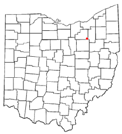
 Location of Wadsworth, Ohio |
|
 Location of Wadsworth in Medina County |
|
| Coordinates: 41°1′40″N 81°43′47″W / 41.02778°N 81.72972°WCoordinates: 41°1′40″N 81°43′47″W / 41.02778°N 81.72972°W | |
| Country | United States |
| State | Ohio |
| County | Medina |
| Founded | 1814 |
| Incorporated | 1876 (village) |
| Incorporated | 1930 (city) |
| Government | |
| • Type | Mayor-Council |
| • Mayor | Robin L. Laubaugh |
| Area | |
| • Total | 10.62 sq mi (27.51 km2) |
| • Land | 10.62 sq mi (27.51 km2) |
| • Water | 0 sq mi (0 km2) |
| Elevation | 1,168 ft (356 m) |
| Population (2010) | |
| • Total | 21,567 |
| • Estimate (2014) | 21,893 |
| • Density | 2,030.8/sq mi (784.1/km2) |
| Time zone | Eastern (EST) (UTC-5) |
| • Summer (DST) | EDT (UTC-4) |
| ZIP codes | 44281-44282 |
| Area code(s) | 234, 330 |
| FIPS code | 39-80304 |
| GNIS feature ID | 1065441 |
| Website | https://www.wadsworthcity.com/ |
Wadsworth is a city in Medina County, Ohio, United States. Founded in 1814, it was named after General Elijah Wadsworth, a Revolutionary War hero. The population was 21,567 at the 2010 census.
A post office called Wadsworth has been in operation since 1823. The city has the name of Elijah Wadsworth, a land agent.
Wadsworth is located at 41°1′40″N 81°43′47″W / 41.02778°N 81.72972°W (41.027867, -81.729768).
According to the United States Census Bureau, the city has a total area of 10.62 square miles (27.51 km2), all land. It is located just a few miles south of the north-south continental divide.
Nearby cities include Akron and Cleveland.
As of 2000 the median income for a household in the city was $48,605, and the median income for a family was $58,850. Males had a median income of $41,626 versus $25,805 for females. The per capita income for the city was $22,859. 5.4% of the population and 4.2% of families were below the poverty line, including 5.7% of those under the age of 18 and 5.6% of those 65 and older.
As of the census of 2010, there were 21,567 people, 8,609 households, and 5,803 families residing in the city. The population density was 2,030.8 inhabitants per square mile (784.1/km2). There were 9,320 housing units at an average density of 877.6 per square mile (338.8/km2). The racial makeup of the city was 96.9% White, 0.8% African American, 0.2% Native American, 0.7% Asian, 0.2% from other races, and 1.1% from two or more races. Hispanic or Latino of any race were 1.2% of the population.
...
Wikipedia
