Villa Regina
| Villa Regina | ||
|---|---|---|

Clockwise from top: Indio Comahue Monument, Downtown Villa Regina, train station and Nuestra Señora del Rosario parish
|
||
|
||
| Nickname(s): La Perla del Valle (The Pearl of the Valley) | ||
| Coordinates: 39°06′S 67°04′W / 39.100°S 67.067°WCoordinates: 39°06′S 67°04′W / 39.100°S 67.067°W | ||
| Country |
|
|
| Province |
|
|
| Established | November 7, 1924 | |
| Government | ||
| • Intendente | Luis Albrieu | |
| Elevation | 184 m (604 ft) | |
| Population (2010) | ||
| • Total | 33,089 | |
| (INDEC census) | ||
| CPA Base | R8336 | |
| Climate | BSk | |
| Website | web |
|
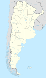
Villa Regina is a city in the General Roca Department of the province of Río Negro, Argentina. The city is connected to the rest of the towns in the Upper Río Negro Valley via National Route 22.
The city was built by the Italian-Argentine Colonization Company (Spanish: Compañía Italo-Argentina de Colonización), which purchased 5,000 hectares for urban development from the estate of Manuel Zorrilla. The lands were divided into four zones of 1,300 hectares, 1,200 hectares, 1,300 hectares, and 1,200 hectares. These zones were then subdivided into lots, which were sold to families that immigrated to Argentina from Italy. The settlement was established on November 7, 1924. It was originally named Colonia Regina de Alvear, after the wife of then-president Marcelo T. de Alvear, who had approved the project. The company developed the town with the help of Italian investors. In 1930, the government of Rio Negro created the municipality of Villa Regina, dissolving the Italian-Argentine Colonization Company. By 1939, the development of the four zones was completed. In 1987 the town wrote its first constitution, doing away with the position of municipal president and replacing it with the position of mayor.
Villa Regina is considered the capital of the Eastern Upper Valley micro-region. The surrounding area produces a large portion of the apple and pear harvests of Patagonia and also has a sizable grape harvest. The economy of the town is complemented by its canning and bottling plants, which compose the local industrial park. The city celebrates the Provincial Grape Harvest Festival annually and also hosts the National Comahue Fair biennially.
The first known mention of the area was an entry in the diary of Colonel Manuel José Olascoaga, an officer in the Argentine army. On June 4, 1879, during the Conquest of the Desert, Olascoaga described it while camping with his troops: "Two hours on the way up from Chichinal, we camped on a place a bit far from the river, close to a water reservoir. [...] The ground is plain with ligere landforms. The canyons to the north increase their altitude westbound." During the expansion of the Buenos Aires Great Southern Railway (Spanish: Ferrocarril del Sur) to the lands conquered during the Desert Campaign, the new route passed by the area because it was flat. Manuel Marcos Zorilla, the private secretary of president Julio Argentino Roca, was given 15,000 hectares there, which he called Zorilla Field (Spanish: Campo Zorilla). Zorrilla officially received the lands in 1895, with the condition that he would have to cede, free of charge, the sections where the tracks of the Ferrocarril del Sur would be built.
...
Wikipedia


