Villa La Angostura
| Villa La Angostura | |
|---|---|
| Village | |
 |
|
| Nickname(s): Jardín de la Patagonia | |
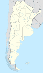
| Location of Villa La Angostura in Argentina | |
| Coordinates: 40°45′44.9″S 71°38′46.7″W / 40.762472°S 71.646306°WCoordinates: 40°45′44.9″S 71°38′46.7″W / 40.762472°S 71.646306°W | |
| Country | Argentina |
| Province | Neuquén |
| Department | Los Lagos |
| Established | 15 May 1932 |
| Government | |
| • Intendant | Roberto Cacault |
| Area | |
| • Total | 79.6 km2 (30.7 sq mi) |
| Elevation | 870 m (2,850 ft) |
| Population (2010 census [INDEC]) | |
| • Total | 11,063 |
| • Density | 140/km2 (360/sq mi) |
| Time zone | ART (UTC-3) |
| CPA base | Q8407 |
| Dialing code | +54 02944 |
| Climate | Cfb |
| Website | Official website |
Villa La Angostura (Spanish for Narrowness-ville) is a village located in the Los Lagos Department in the south of the Argentine province of Neuquén, on the northwest shore of the Nahuel Huapi Lake.
Nestled in the northern part of the Nahuel Huapi National Park, and surrounded by lakes, forests and mountains, it is considered to be one of the most beautiful locations in the mountainous parts of Patagonia; earning it the nickname 'Garden of Patagonia (Spanish: Jardín de la Patagonia).
Just located a couple of kilometers away from the border with Chile through the Cardenal Antonio Samoré Pass and with other nearby places such as Bariloche and San Martin de los Andes, it forms a popular tourist corridor during both summer and winter.
The village is located halfway between the cities of San Martín de los Andes and Bariloche, inside the Nahuel Huapi National Park, very close to the isthmus of the Quetrihue Peninsula, where the Los Arrayanes National Park and its arrayanes (Luma apiculata) forest is located. The town is located nearby Cardenal Antonio Samoré Pass that links it with Osorno in Chile.
The elevation of the city centre is about 790 m, the lake is at 765 m. Surrounding mountains range from 1,500 m to about 2,000 m (Cerro Bayo, right behind the city, is 1,782 m high).
...
Wikipedia

