Vierville-sur-Mer
| Vierville-sur-Mer | ||
|---|---|---|
 |
||
|
||
| Coordinates: 49°22′30″N 0°54′14″W / 49.375°N 0.9039°WCoordinates: 49°22′30″N 0°54′14″W / 49.375°N 0.9039°W | ||
| Country | France | |
| Region | Normandy | |
| Department | Calvados | |
| Arrondissement | Bayeux | |
| Canton | Trévières | |
| Intercommunality | Trévières | |
| Government | ||
| • Mayor (2008–2014) | Jean-Marie Oxéant | |
| Area1 | 6.41 km2 (2.47 sq mi) | |
| Population (2008)2 | 241 | |
| • Density | 38/km2 (97/sq mi) | |
| Time zone | CET (UTC+1) | |
| • Summer (DST) | CEST (UTC+2) | |
| INSEE/Postal code | 14745 / 14710 | |
| Elevation | 0–62 m (0–203 ft) (avg. 46 m or 151 ft) |
|
|
1 French Land Register data, which excludes lakes, ponds, glaciers > 1 km² (0.386 sq mi or 247 acres) and river estuaries. 2Population without double counting: residents of multiple communes (e.g., students and military personnel) only counted once. |
||
1 French Land Register data, which excludes lakes, ponds, glaciers > 1 km² (0.386 sq mi or 247 acres) and river estuaries.
Vierville-sur-Mer is a commune in the Calvados department in Normandie region in northwestern France.
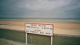
On 6 June 1944 (D-Day), the U.S. Army's 116th Infantry Regiment of the 29th Infantry Division, along with the 5th Ranger Battalion, and A, B, and C Companies of the 2nd Ranger Battalion landed on Dog Green, Dog White, Dog Red, and Easy Green sectors of Omaha Beach, below Vierville-sur-Mer, starting at 6.30 am.
...
Wikipedia


