Vernon Parish, LA
| Vernon Parish, Louisiana | |
|---|---|

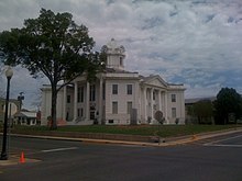
Vernon Parish Courthouse
|
|
 Location in the U.S. state of Louisiana |
|
 Louisiana's location in the U.S. |
|
| Founded | March 30, 1871 |
| Named for | Mount Vernon |
| Seat | Leesville |
| Largest city | Leesville |
| Area | |
| • Total | 1,341 sq mi (3,473 km2) |
| • Land | 1,328 sq mi (3,440 km2) |
| • Water | 14 sq mi (36 km2), 1.0% |
| Population (est.) | |
| • (2015) | 50,803 |
| • Density | 39/sq mi (15/km²) |
| Congressional district | 4th |
| Time zone | Central: UTC-6/-5 |
| Website | www |
Vernon Parish (French: Paroisse de Vernon) is a parish located in the U.S. state of Louisiana. As of the 2010 census, the population was 52,334. The parish seat is Leesville. Bordered on the west by the Sabine River, the parish was founded in 1871 during the Reconstruction era.
It was long a center of the timber industry, which harvested pine in the hills and bottomland hardwoods. Construction of a railway to the area in 1897 stimulated marketing of lumber and businesses in the area.
Since World War II, Fort Polk has been most important to the parish economy. The population of the Leesville rapidly increased fivefold after the fort was opened. Vernon Parish is part of the Fort Polk South, LA Micropolitan Statistical Area, which is also included in the DeRidder-Fort Polk South, LA Combined Statistical Area.
The area comprising Vernon was a part of a tract of land whose control was disputed in the late 18th century between the United States and Spain. They called this land the "Neutral Strip" and refrained from posting police or military personnel there. As a result, the area became a haven for outlaws. Prior to the United States acquisition of this territory through the Louisiana Purchase from France in 1803, the primary settlers who came to the area were ethnic French and Spanish.
...
Wikipedia
