Verkhoyansky District
| Verkhoyansky District Верхоянский улус (Russian) Үөһээ Дьааҥы улууhа (Sakha) |
|
|---|---|
 Location of Verkhoyansky District in the Sakha Republic |
|
| Coordinates: 67°33′N 133°23′E / 67.550°N 133.383°ECoordinates: 67°33′N 133°23′E / 67.550°N 133.383°E | |
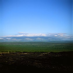
 Mat-Gora, Verkhoyansky District |
|
|
|
|
| Location | |
| Country | Russia |
| Federal subject | Sakha Republic |
| Administrative structure (as of June 2009) | |
| Administrative center | settlement of Batagay |
| Administrative divisions: | |
| Towns under district jurisdiction | 1 |
| Settlements | 2 |
| Rural okrugs | 14 |
| Inhabited localities: | |
| Cities/towns | 1 |
| Urban-type settlements | 2 |
| Rural localities | 26 |
| Municipal structure (as of December 2008) | |
| Municipally incorporated as | Verkhoyansky Municipal District |
| Municipal divisions: | |
| Urban settlements | 3 |
| Rural settlements | 14 |
| Statistics | |
| Area (June 2009) | 137,400 km2 (53,100 sq mi) |
| Population (2010 Census) | 12,815 inhabitants |
| • Urban | 46.2% |
| • Rural | 53.8% |
| Density | 0.09/km2 (0.23/sq mi) |
| Time zone | VLAT (UTC+10:00) |
| Established | January 5, 1967 |
| Official website | |
| on | |
Verkhoyansky District (Russian: Верхоя́нский улу́с; Yakut: Үөһээ Дьааҥы улууһа, Üöhee Caañı uluuha, IPA: [ˈyøheː ɟaːŋɯ uluːha]) is an administrative and municipal district (raion, or ulus), one of the thirty-four in the Sakha Republic, Russia. It is located in the northern central part of the republic and borders with Ust-Yansky District in the northeast, Momsky District in the east, Tomponsky District in the south, Kobyaysky District in the southwest, Eveno-Bytantaysky National District in the west, and with Bulunsky District in the northwest. The area of the district is 137,400 square kilometers (53,100 sq mi). Its administrative center is the urban locality (a settlement) of Batagay. Population: 12,815 (2010 Census); 13,666 (2002 Census);24,259 (1989 Census). The population of Batagay accounts for 34.1% of the district's total population.
The main river in the district is the Yana.
...
Wikipedia


