Vaudreuil-Soulanges Regional County Municipality
| Vaudreuil-Soulanges | |
|---|---|
| Regional county municipality | |

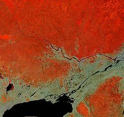
Vaudreuil-Soulanges forms a triangle (centre right) west of the confluence of the Ottawa and Saint Lawrence Rivers in this satellite image.
|
|
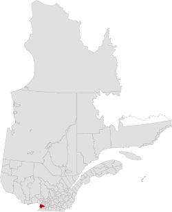
 Location in province of Quebec. |
|
| Coordinates: 45°21′N 74°13′W / 45.350°N 74.217°WCoordinates: 45°21′N 74°13′W / 45.350°N 74.217°W | |
| Country |
|
| Province |
|
| Region | Montérégie |
| Effective | April 14, 1982 |
| County seat | Vaudreuil-Dorion |
| Government | |
| • Type | Prefecture |
| • Prefect | Robert Sauvé |
| Area | |
| • Total | 1,019.70 km2 (393.71 sq mi) |
| • Land | 855.36 km2 (330.26 sq mi) |
| Population (2011) | |
| • Total | 139,353 |
| • Density | 162.9/km2 (422/sq mi) |
| • Pop 2006-2011 |
|
| • Dwellings | 55,203 |
| Time zone | EST (UTC−5) |
| • Summer (DST) | EDT (UTC−4) |
| Area code(s) | 450 and 579 |
| Website | www |
Vaudreuil-Soulanges is a regional county municipality in Quebec, Canada. It is located on a triangular peninsula in the western Montérégie region of Quebec, surrounded by the Ottawa River to the north, the St. Lawrence River to the south, and Ontario to the west.
Vaudreuil-Soulanges is part of the St Lawrence Valley. Two million years ago the region was subject to a series of glaciations that covered much of North America. The last in the series was the Wisconsin glaciation. The ice sheet weighed down the landscape. This created the depressions in the land that created the basins for Lake Saint-Louis, Lac des Deux-Montagnes and Lake Saint-Francis. As the ice sheet eroded, the region was mostly submerged 12000 years ago by an inland saltwater sea known as the Champlain sea. Once the glacier was melted the landscape rose again and pushed the saltwater into the sea. 10000 years ago the body of water, now a fresh water lake, has been named by scholars as Lake Lampsilis.
Prior to the British conquest, the region was divided into several seigneuries populated by French colonists. The seigneurial system was finally abolished in 1854.
It is the only county in Quebec south of the Ottawa River, owing to the desire to keep the French-speaking population of the area within Lower Canada during the 1791 division of Upper and Lower Canada (precursors to the provinces of Ontario and Quebec). It is also geographically isolated from the Montérégie region, being its only county north of the St. Lawrence River.
...
Wikipedia
