Valbonne
| Valbonne | ||
|---|---|---|
| Commune | ||

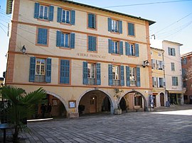
Main square
|
||
|
||
| Coordinates: 43°38′33″N 7°00′34″E / 43.6424°N 7.0095°ECoordinates: 43°38′33″N 7°00′34″E / 43.6424°N 7.0095°E | ||
| Country | France | |
| Region | Provence-Alpes-Côte d'Azur | |
| Department | Alpes-Maritimes | |
| Arrondissement | Grasse | |
| Canton | Valbonne | |
| Intercommunality | CA Sophia Antipolis | |
| Government | ||
| • Mayor (2008–2014) | Marc Daunis | |
| Area1 | 18.97 km2 (7.32 sq mi) | |
| Population (2008)2 | 12,500 | |
| • Density | 660/km2 (1,700/sq mi) | |
| Time zone | CET (UTC+1) | |
| • Summer (DST) | CEST (UTC+2) | |
| INSEE/Postal code | 06152 /06560 | |
| Elevation | 75–302 m (246–991 ft) (avg. 200 m or 660 ft) |
|
|
1 French Land Register data, which excludes lakes, ponds, glaciers > 1 km² (0.386 sq mi or 247 acres) and river estuaries. 2Population without double counting: residents of multiple communes (e.g., students and military personnel) only counted once. |
||
1 French Land Register data, which excludes lakes, ponds, glaciers > 1 km² (0.386 sq mi or 247 acres) and river estuaries.
Valbonne is a commune near Nice in the Alpes-Maritimes department in the Provence-Alpes-Côte d'Azur region in southeastern France. Valbonne means "the good valley" in Provençal and translates to "Vaubona" in Occitan.
The commune is part of the Communauté d'agglomération de Sophia Antipolis. The technology park of Sophia Antipolis is partly located in Valbonne.
Valbonne is situated in a basin, halfway along the Brague river. The commune consists of two sites:
There are traces of prehistoric human settlement in the area that date back to the Iron Age, the first days of agriculture. Many prehistoric artifacts such as Neolithic stone axes, funeral urns from the Bronze Age, and fragments of amphora, oil and grain jars (dolia) have been excavated. The remains of an aqueduct constructed during Roman settlement in the 3rd century A.D. are also present in the area of Clausonne.
In the High Middle Ages several neighbouring hamlets (Opio, Le Brusc, Sartoux, les Clausonnes and Villebruc) already existed. But the small, isolated valley of Valbonne was deserted. In 1199 the land was offered by the bishop of Antibes to the abbey of Prads (Prads-Haute-Bleone, Alpes-de-Haut-Provence) who founded the abbey of St. Mary. At the time, this area was called Vallis Bona, meaning "the good valley". Later, it became known as Valbonne.
Prads and Valbonne were two of the 15 abbeys and priories of the monastic order of Chalais, an order of "Dauphinois-Provençal" monks. The order was created a century earlier and was similar to the Cistercians. The poverty of these mountain-dwellers caused their disintegration and, in 1297 the abbot of Valbonne came under the authority of the abbey of St. Andrew of Villeneuve-les-Avignon. The bishop of Grasse refused to ratify the arrangement, and in 1303 offered St. Mary to the abbey of Lérins. In 1335 the Pope settled the question - he allocated St. Mary to Lérins.
...
Wikipedia


