Uwharrie National Forest
| Uwharrie National Forest | |
|---|---|
|
IUCN category VI (protected area with sustainable use of natural resources)
|
|

Fishing pier at Kings Mountain Point Day Use Area
|
|
| Location | North Carolina, United States |
| Nearest city | Albemarle, NC |
| Coordinates | 35°21′59″N 79°57′51″W / 35.3663062°N 79.964034°WCoordinates: 35°21′59″N 79°57′51″W / 35.3663062°N 79.964034°W |
| Area | 50,645 acres (204.95 km2) |
| Established | January 12, 1961 |
| Governing body | U.S. Forest Service |
| Uwharrie National Forest | |
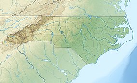
Uwharrie National Forest (local pronunciation: /juːˈwɑːri/ ew-WAR-ee) is a federally designated national forest region located primarily in Montgomery County, but also extending into Randolph and Davidson counties in south central North Carolina. It is the smallest of the four National Forests in North Carolina, with a total area of 50,645 acres (204.95 km2). About 79% of its acreage is in Montgomery County. The forest is managed together with the other three North Carolina National Forests (Croatan, Nantahala, and Pisgah) from common headquarters in Asheville, North Carolina. However, it does have a local ranger district office in Troy, North Carolina. There is one officially designated wilderness area within the forest—the 5,025-acre (20.34 km²) Birkhead Mountains Wilderness.
The forest derives its name from the Uwharrie Mountains, the ancient mountains atop which most of the forest sits. The western border of the forest is made by the Yadkin River and Great Pee Dee River while the northern border follows the northernmost range of the Uwharries near Asheboro. To the east, the forest is bordered by the Montgomery County seat of Troy.
...
Wikipedia


