Upolu

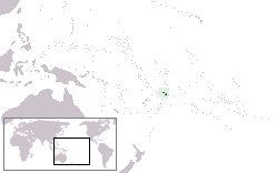
Map of Samoa
|
|
| Geography | |
|---|---|
| Location | Pacific Ocean |
| Coordinates | 13°55′S 171°45′W / 13.917°S 171.750°W |
| Area | 1,125 km2 (434 sq mi) |
| Length | 75 km (46.6 mi) |
| Administration | |
|
Samoa
|
|
| Largest settlement | Apia (pop. 58,800) |
| Demographics | |
| Population | 143,418 (2011) |
| Pop. density | 127 /km2 (329 /sq mi) |
| Ethnic groups | 92.6% Samoans, 7% Euronesians (persons of European and Polynesian blood), 0.4% Europeans |
Upolu is an island in Samoa, formed by a massive basaltic shield volcano which rises from the seafloor of the western Pacific Ocean. The island is 75 kilometres (47 miles) long, 1,125 square kilometres (434 square miles) in area, and is the second largest in geographic area as well as with 135,000 people the most populated of the Samoan Islands. Upolu is situated to the southeast of the "big island", Savai'i. The capital Apia is in the middle of the north coast with Faleolo International Airport at the western end of the island. The island has not had any historically recorded eruptions, although three lava flows date back only a few hundred to a few thousand years.
In the Samoan branch of Polynesian mythology, Upolu was the first woman on the island of the same name.
In 1841, the island was the site of the Bombardment of Upolu, an incident during the United States Exploring Expedition.
In the late-19th century, the Scottish writer Robert Louis Stevenson owned a 400-acre (160-hectare) estate at Vailima village and died there in 1894. He is buried at the top of Mount Vaea above his former home. The Vailima estate was purchased in 1900 as the official residence for the German governor and, after British/Dominion confiscation, served successively as residence for the New Zealand administrator and for the Samoan head of state after independence.
...
Wikipedia

