Samoan Islands

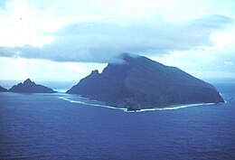
Above: Olosega island in the Manu'a group, eastern Samoa Islands. Below: out-of-date map of the Samoan Islands (the International Date Line crosses between Samoa and American Samoa as of December 29, 2011)
|
|
| Geography | |
|---|---|
| Location | Polynesia |
| Area | 3,030 km2 (1,170 sq mi) |
| Highest elevation | 1,858 m (6,096 ft) |
| Highest point | Mauga Silisili |
| Administration | |
| Largest settlement | Apia (pop. 38,800) |
| Largest settlement | Tafuna (pop. pop. 9,756) |
| Demographics | |
| Population | 249,839 (2012) |
The Samoan Islands are an archipelago covering 3,030 km2 (1,170 sq mi) in the central South Pacific, forming part of Polynesia and the wider region of Oceania. Administratively, the archipelago comprises all of Samoa and most of American Samoa (apart from Swains Island, which is part of the Tokelau Islands). The two Samoan jurisdictions are separated by 64 km of ocean.
The population of the Samoan Islands is approximately 250,000, sharing a common language, Samoan, a culture, known as fa'a Samoa and an indigenous form of governance called fa'amatai.
Most Samoans are full-blooded and are one of the largest Polynesian populations in the world.
The oldest date so far from prehistoric remains in the Samoan Islands has been calculated from archaeology in Samoa to a likely true age of c. 1050 BCE from a Lapita site at Mulifanua wharf on Upolu island.
In 1768, the eastern islands were visited by French explorer Bougainville, who named them the Navigator Islands, a name used by missionaries until about 1845 and in official European dispatches until about 1870.
Politically the two jurisdictions of the Samoa Islands are;
In the late 1800s, rivalry between the United States, Germany, and the United Kingdom resulted in the Tripartite Convention (1899) that formally partitioned the Samoan archipelago into a German colony (German Samoa) and a United States territory (American Samoa). Forerunners to the Tripartite Convention of 1899 were the Washington Conference of 1887, the Treaty of Berlin of 1889, and the Anglo-German Agreement on Samoa of 1899. New Zealand occupied the German colony through 1920, then governed the western islands until independence in 1962 as a (1) League of Nations Class C Mandate and (2) United Nations Trust Territory after 1946. The pro-independence Mau movement across the islands eventually led to the political independence of the western islands from New Zealand in 1962 while the eastern islands, American Samoa, remains a political territory of the United States.
...
Wikipedia

