Umatilla River
| Umatilla River | |
|
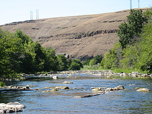
Umatilla flowing through north Pendleton
|
|
| Name origin: Native American (Indian) name for the river | |
| Country | United States |
|---|---|
| State | Oregon |
| County | Umatilla |
| Source | Confluence of north and south forks |
| - location | Blue Mountains |
| - elevation | 2,332 ft (711 m) |
| - coordinates | 45°43′32″N 118°11′17″W / 45.72556°N 118.18806°W |
| Mouth | Columbia River |
| - location | Umatilla, Oregon |
| - elevation | 269 ft (82 m) |
| - coordinates | 45°55′09″N 119°21′20″W / 45.91917°N 119.35556°WCoordinates: 45°55′09″N 119°21′20″W / 45.91917°N 119.35556°W |
| Length | 89 mi (143 km) |
| Basin | 2,450 sq mi (6,345.5 km2) |
| Discharge | for near Umatilla, 2.1 miles (3.4 km) from the mouth |
| - average | 494 cu ft/s (14.0 m3/s) |
| - max | 19,800 cu ft/s (560.7 m3/s) |
| - min | 0 cu ft/s (0.0 m3/s) |
The Umatilla River is an 89-mile (143 km) tributary of the Columbia River in the U.S. state of Oregon.Draining a basin of 2,450 square miles (6,300 km2), it enters the Columbia near the city of Umatilla in the northeastern part of the state. In downstream order, beginning at the headwaters, major tributaries of the Umatilla River are the North Fork Umatilla River and the South Fork Umatilla River, then Meacham, McKay, Birch, and Butter creeks.
The name Umatilla is derived from the Native American name for the river, which was first recorded as Youmalolam in the journals of the Lewis and Clark Expedition and spelled in many other ways in early books about Oregon.
The Umatilla River's headwaters lie in the Blue Mountains at the confluence of its north and south forks in the Umatilla National Forest of northeastern Oregon. Flowing generally west, the river receives Lick Creek and Bear Creek, both from the before reaching the unincorporated community of Bingham Springs. Further downstream it receives Rock Creek from the right, then Bobsled, Augur, and Ryan creeks from the left before entering the Umatilla Indian Reservation and reaching the unincorporated community of Gibbon. From Gibbon to the river mouth, tracks of the Union Pacific Railroad run parallel to the stream. Between Gibbon and Cayuse, three creeks—Squaw, Buckaroo, and Coonskin—enter the river from the left. Downstream of Cayuse, Moonshine, Cottonwood, and Mission creeks also enter from the left.
...
Wikipedia


