Umatilla National Forest
| Umatilla National Forest | |
|---|---|
|
IUCN category VI (protected area with sustainable use of natural resources)
|
|

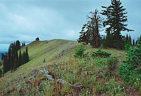
Oregon Butte in the Wenaha–Tucannon Wilderness, Umatilla NF
|
|
| Location | Oregon / Washington, United States |
| Nearest city | Elgin, Oregon |
| Coordinates | 45°38′00″N 118°11′00″W / 45.63333°N 118.18333°WCoordinates: 45°38′00″N 118°11′00″W / 45.63333°N 118.18333°W |
| Area | 1,407,087 acres (5,694 km2) |
| Established | July 1, 1908 |
| Visitors | 703,000 (in 2006) |
| Governing body | U.S. Forest Service |
| Website | Umatilla National Forest |
The Umatilla National Forest, in the Blue Mountains of northeast Oregon and southeast Washington, covers an area of 1.4 million acres (5,700 km2). In descending order of land area the forest is located in parts of Umatilla, Grant, Columbia, Morrow, Wallowa, Union, Garfield, Asotin, Wheeler, and Walla Walla counties. (Columbia, Garfield, Asotin, and Walla Walla counties are in Washington, while the rest are in Oregon.) More than three-quarters of the forest lies in the state of Oregon. Forest headquarters are located in Pendleton, Oregon. There are local ranger district offices in Heppner and Ukiah in Oregon, and in Pomeroy and Walla Walla in Washington.
The Umatilla National Forest takes its name from the Umatilla Indian word meaning "water rippling over sand." Explorers Lewis and Clark passed through the area in 1805 on the Columbia River, and Marcus and Narcissa Whitman passed through in 1836 to establish a mission at Wailatpu near Walla Walla, Washington. Thousands of emigrants later followed the Oregon Trail west, and many remained in the Blue Mountain region. Discovery of gold in Oregon in 1851 led to the settlement of the North Fork John Day River area. More than $10 million in gold and silver were mined, and remnants of the era are still visible in the National Forest. Some claims are still being mined.
...
Wikipedia

