U.S. Route 302
| U.S. Route 302 | |
|---|---|
 |
|
| Route information | |
| Auxiliary route of US 2 | |
| Length: | 171 mi (275 km) |
| Existed: | 1935 – present |
| Major junctions | |
| West end: |
|
|
|
| East end: |
|
| Location | |
| States: | Vermont, New Hampshire, Maine |
| Highway system | |
| State Route 18 | |
|---|---|
| Location: | Conway, NH—Portland |
| Length: | 54.18 mi (87.19 km) |
| Existed: | 1926–1935 |
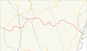
U.S. Route 302 (US 302) is an east–west spur of U.S. Route 2 in northern New England in the United States. It currently runs 171 miles (275 km) from Montpelier, Vermont, at US 2, to Portland, Maine, at U.S. Route 1. It passes through the states of Vermont, New Hampshire and Maine.
US 302 enters Vermont after crossing the Connecticut River at the village of Wells River. The highway crosses US 5 in the center of the village. The next major intersection for US 302 is its intersection with Interstate 91 in Newbury, about 2.7 miles (4.3 km) from the US 5 intersection. US 302 then winds through the rural towns of Ryegate, Groton, Topsham, and Orange, before entering East Barre. In East Barre, its intersection with Vermont Route 110 takes the form of a roundabout. After traveling down out of the hills surrounding the city of Barre, US 302 makes up Washington Street and Main Street of Barre. It runs along the Jail Branch River and the Stevens Branch of the Winooski River in Barre, then through Berlin, finally terminating at its US 2 intersection in southeast Montpelier.
...
Wikipedia

