Carroll, NH
| Carroll, New Hampshire | |
|---|---|
| Town | |

|
|
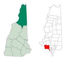
 Location in Coos County, New Hampshire |
|
| Coordinates: 44°17′54″N 71°32′26″W / 44.29833°N 71.54056°WCoordinates: 44°17′54″N 71°32′26″W / 44.29833°N 71.54056°W | |
| Country | United States |
| State | New Hampshire |
| County | Coos |
| Incorporated | 1832 |
| Government | |
| • Board of Selectmen | Brian Mycko, Chair Paul Bussiere David Scalley |
| Area | |
| • Total | 50.2 sq mi (130.0 km2) |
| • Land | 50.2 sq mi (130.0 km2) |
| • Water | 0.04 sq mi (0.1 km2) 0.06% |
| Elevation | 1,437 ft (438 m) |
| Population (2010) | |
| • Total | 763 |
| • Density | 15/sq mi (5.9/km2) |
| Time zone | Eastern (UTC-5) |
| • Summer (DST) | Eastern (UTC-4) |
| ZIP code | 03598 |
| Area code(s) | 603 |
| FIPS code | 33-10100 |
| GNIS feature ID | 0873560 |
| Website | www |
Carroll is a town in Coos County, New Hampshire, United States. The population was 763 at the 2010 census. The two largest villages are Twin Mountain and Bretton Woods. Carroll is an important access point for recreational areas in the White Mountains, including many 4,000-footers, the Zealand River area, the Presidential Range, and the Presidential Dry River Wilderness. The town is crossed by the Appalachian Trail and is home to the Mount Washington Hotel at Bretton Woods. It is also home to the Highland Center at Crawford Notch, the Appalachian Mountain Club's four-season lodge.
Carroll is part of the Berlin, NH–VT Micropolitan Statistical Area.
It was granted by Governor John Wentworth on February 8, 1772 to Sir Thomas Wentworth, Samuel Langdon and 81 others. Sir Thomas Wentworth resided in West Bretton, England on his estate called Bretton Hall, after which the township was named Bretton Woods. On the 1816 Carrigain map of New Hampshire, it appears as "Breton Woods." On 22 June 1832, the town was incorporated by the General Court as Carroll, in honor of Charles Carroll, a signer of the Declaration of Independence.
...
Wikipedia
