U.S. Route 22 in New Jersey
| U.S. Route 22 | ||||
|---|---|---|---|---|

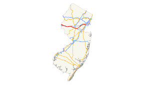
US 22 highlighted in red
|
||||
| Route information | ||||
| Maintained by NJDOT and DRJTBC | ||||
| Length: | 60.53 mi (97.41 km) | |||
| Major junctions | ||||
| West end: |
|
|||
|
|
||||
| East end: |
|
|||
| Location | ||||
| Counties: | Warren, Hunterdon, Somerset, Union, Essex | |||
| Highway system | ||||
|
||||
New Jersey State Highway Routes
U.S. Route 22 (US 22) is a U.S. highway stretching from Cincinnati, Ohio in the west to Newark, New Jersey in the east. In New Jersey, the route runs for 60.53 mi (97.41 km) from the Easton-Phillipsburg Toll Bridge over the Delaware River in Phillipsburg, Warren County to Interstate 78 (I-78), US 1/9, and Route 21 at the Newark Airport Interchange in Newark, Essex County. The road first heads through the Phillipsburg-Alpha area as a surface divided highway before running concurrent with I-78 through mountainous and agricultural sections of western New Jersey between Alpha and east of Clinton in Hunterdon County. For the remainder of the route, US 22 runs to the south of I-78 through mostly suburban areas as a four- to six-lane surface divided highway, passing through Hunterdon, Somerset, Union, and Essex counties. Along this portion, it intersects US 202 and US 206 in Somerville, I-287 in Bridgewater Township, and the Garden State Parkway in Union.
...
Wikipedia

