Clinton Township, New Jersey
| Clinton Township, New Jersey | |
|---|---|
| Township | |
| Township of Clinton | |

Jones Tavern in Annandale
|
|
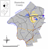
 Map of Clinton Township in Hunterdon County. Inset: Location of Hunterdon County highlighted in the State of New Jersey. |
|
 Census Bureau map of Clinton Township, New Jersey |
|
| Coordinates: 40°37′48″N 74°52′02″W / 40.630098°N 74.867202°WCoordinates: 40°37′48″N 74°52′02″W / 40.630098°N 74.867202°W | |
| Country | |
| State |
|
| County | Hunterdon |
| Incorporated | April 12, 1841 |
| Named for | DeWitt Clinton |
| Government | |
| • Type | Faulkner Act (Small Municipality) |
| • Body | Township Council |
| • Mayor | John Higgins (R, term ends December 31, 2017) |
| • Administrator | Marvin Joss |
| • Clerk | Carla Conner |
| Area | |
| • Total | 33.823 sq mi (87.603 km2) |
| • Land | 29.876 sq mi (77.379 km2) |
| • Water | 3.947 sq mi (10.224 km2) 11.67% |
| Area rank | 72nd of 566 in state 5th of 26 in county |
| Elevation | 518 ft (158 m) |
| Population (2010 Census) | |
| • Total | 13,478 |
| • Estimate (2015) | 13,022 |
| • Rank | 185th of 566 in state 3rd of 26 in county |
| • Density | 451.1/sq mi (174.2/km2) |
| • Density rank | 450th of 566 in state 14th of 26 in county |
| Time zone | Eastern (EST) (UTC-5) |
| • Summer (DST) | Eastern (EDT) (UTC-4) |
| ZIP code | 08809 - Clinton 08801 - Annandale 08833 - Lebanon |
| Area code(s) | 908 |
| FIPS code | 3401913750 |
| GNIS feature ID | 0882177 |
| Website | www |
Clinton Township is a township in Hunterdon County, New Jersey, United States. As of the 2010 United States Census, the township's population was 13,478, reflecting an increase of 521 (+4.0%) from the 12,957 counted in the 2000 Census, which had in turn increased by 2,141 (+19.8%) from the 10,816 counted in the 1990 Census.
Clinton Township was incorporated as a township by an act of the New Jersey Legislature on April 12, 1841, from portions of Lebanon Township, based on the results of a referendum held that same day. Portions of the township have been taken to form Clinton town (April 5, 1865, within the township; became independent in 1895), High Bridge township (March 29, 1871) and Lebanon borough (March 26, 1926). The township was named for Governor of New York DeWitt Clinton.
According to the United States Census Bureau, the township had a total area of 33.823 square miles (87.603 km2), including 29.876 square miles (77.379 km2) of land and 3.947 square miles (10.224 km2) of water (11.67%).
Annandale (with a 2010 Census population of 1,695) is a census-designated place and unincorporated community located within Clinton Township.
Other unincorporated communities, localities and place names located partially or completely within the township include Allerton, Cedar Heights, Cokesbury, Hamden, Mariannes Corner, McPherson, Potterstown, Readingsburgh, Stone Mill and Sunnyside.
...
Wikipedia
