Somerset County, New Jersey
| Somerset County, New Jersey | ||
|---|---|---|

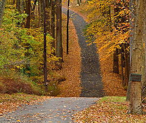
A walking path in Basking Ridge
|
||
|
||
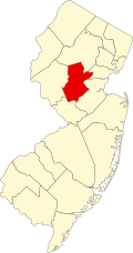
 Location in the U.S. state of New Jersey |
||
 New Jersey's location in the U.S. |
||
| Founded | May 14, 1688 | |
| Named for | English county of Somerset | |
| Seat | Somerville | |
| Largest city |
Franklin Township (population) Hillsborough Township (area) |
|
| Area | ||
| • Total | 304.86 sq mi (790 km2) | |
| • Land | 301.81 sq mi (782 km2) | |
| • Water | 3.04 sq mi (8 km2), 1.00% | |
| Population | ||
| • (2010) | 323,444 333,654 (2015 est.) |
|
| • Density | 1,105/sq mi (426.8/km²) | |
| Congressional districts | 7th, 12th | |
| Website | www |
|
| Somerville, New Jersey | ||||||||||||||||||||||||||||||||||||||||||||||||||||||||||||
|---|---|---|---|---|---|---|---|---|---|---|---|---|---|---|---|---|---|---|---|---|---|---|---|---|---|---|---|---|---|---|---|---|---|---|---|---|---|---|---|---|---|---|---|---|---|---|---|---|---|---|---|---|---|---|---|---|---|---|---|---|
| Climate chart () | ||||||||||||||||||||||||||||||||||||||||||||||||||||||||||||
|
||||||||||||||||||||||||||||||||||||||||||||||||||||||||||||
|
||||||||||||||||||||||||||||||||||||||||||||||||||||||||||||
| J | F | M | A | M | J | J | A | S | O | N | D |
|
3.6
38
18
|
2.8
41
20
|
3.9
50
27
|
4.1
61
36
|
4.3
72
46
|
4.4
80
56
|
4.8
85
61
|
4
83
60
|
4.3
76
52
|
4.2
64
40
|
3.6
54
31
|
3.8
42
23
|
| Average max. and min. temperatures in °F | |||||||||||
| Precipitation totals in inches | |||||||||||
| Source: The Weather Channel | |||||||||||
| Metric conversion | |||||||||||
|---|---|---|---|---|---|---|---|---|---|---|---|
| J | F | M | A | M | J | J | A | S | O | N | D |
|
91
3
−8
|
72
5
−7
|
100
10
−3
|
104
16
2
|
110
22
8
|
110
27
13
|
123
29
16
|
101
28
16
|
108
24
11
|
107
18
4
|
...
| |

