Tyrone Township, Blair County, Pennsylvania
| Tyrone Township, Blair County, Pennsylvania |
|
|---|---|
| Township | |

Reconstruction of Fort Roberdeau
|
|
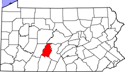
 Map of Blair County, Pennsylvania highlighting Tyrone Township |
|
 Map of Blair County, Pennsylvania |
|
| Country | United States |
| State | Pennsylvania |
| County | Blair |
| Settled | 1775 |
| Incorporated | 1787 |
| Government | |
| • Type | Board of Supervisors |
| Area | |
| • Total | 41.9 sq mi (108.4 km2) |
| • Land | 41.8 sq mi (108.3 km2) |
| • Water | 0.04 sq mi (0.1 km2) |
| Population (2010) | |
| • Total | 1,885 |
| • Density | 45/sq mi (17.4/km2) |
| Time zone | Eastern (EST) (UTC-5) |
| • Summer (DST) | EDT (UTC-4) |
| Area code(s) | 814 |
Tyrone Township is a township in Blair County, Pennsylvania, United States. It is part of the Altoona, PA Metropolitan Statistical Area. The population was 1,885 at the 2010 census.
It was named after County Tyrone in Ireland.
The Birmingham Bridge, Fort Roberdeau, Jacob Isett House and Store, and St. John's Evangelical Lutheran Church are listed on the National Register of Historic Places.
Shortly after 11:00 a.m. EST on July 19, 1996, an F1 tornado touched down northeast of Altoona approximately 1 mile northwest of Sickles Corner on Brush Mountain. This tornado moved southeast taking down a swath of trees and causing minor damage to homes along a 1.5 mile path before ending one half mile southeast of Sickles Corner. The path width averaged about one half mile wide. This storm was the fourth in the family of tornadoes that had crossed Clarion, Jefferson, Indiana, Clearfield and Cambria counties.
...
Wikipedia
