Tur'an
Tur'an
|
||
|---|---|---|
| Hebrew transcription(s) | ||
| • ISO 259 | Ṭurˁan, Turˁan | |

Abu Baker Sadic Mosque, Tur'an, 2011
|
||
|
||
| Coordinates: 32°46′37″N 35°22′33″E / 32.77694°N 35.37583°ECoordinates: 32°46′37″N 35°22′33″E / 32.77694°N 35.37583°E | ||
| Grid position | 185/242 PAL | |
| District | Northern | |
| Government | ||
| • Type | Local council (from 1959) | |
| Population (2015) | ||
| • Total | 13,337 | |
| Name meaning | Possibly from "an outlet of water", Syriac form | |
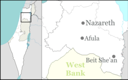
Tur'an (Arabic: طرعان, Hebrew: תֻּרְעָן) is an Arab town in the Northern District of Israel. It is located at the foot of Mount Tur'an and the Tur'an Valley, near the main road from Haifa to Tiberias, and about 7 kilometres (4.3 mi) north of Nazareth. In 2015 it had a population of 13,337.
Pottery and building remains from the Iron Age I have been excavated in the village. Apparently Tur'an was at that time (10-9th centuries B.C.E.) surrounded by a city wall. Apparently it was of a considerable size in the late tenth to the mid-ninth centuries BCE.
The Palestine Exploration Fund's Survey of Western Palestine (SWP) found caves and rock-cut cisterns in the village, which they noted appeared to be an ancient site.
The village was known in the Roman and Byzantine periods (Mishnaic and Talmudic times, respectively) as Tir'an. It was a Jewish village whose inhabitants probably converted to Islam by the end of the early Islamic Arab period (7th-10th centuries) in Palestine.
Pottery from the early Islamic (7th century CE), and Mamluk (14th century CE) have also been excavated, together with building remains from the same period.
...
Wikipedia


