Tuensang district
| Tuensang district | |
|---|---|
| District | |

A woman from Tuensang district
|
|
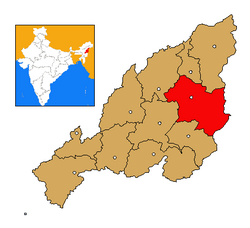
 Tuensang district's location in Nagaland |
|
| Coordinates: 26°14′N 94°49′E / 26.233°N 94.817°ECoordinates: 26°14′N 94°49′E / 26.233°N 94.817°E | |
| State | Nagaland |
| Country | India |
| Seat | Tuensang |
| Population (2011) | |
| • Total | 196,801 |
| Time zone | IST (UTC+05:30) |
| ISO 3166 code | IN-NL-TU |
| Website | http://tuensang.nic.in/ |
Tuensang District (Pron:/ˌtjuːənˈsæŋ/) is the largest and the eastern most district of Nagaland, a state in North-East India. Its headquarters is Tuensang.
Tuensang is one of the original three districts, along with Mokokchung district and Kohima district formed at the time the state was created. Over the decades, the district has gradually diminished in size with the carving out of Mon, Longleng and Kiphire districts from it.
Owing to extreme backwardness of this district, there was a special provision for administration of Tuensang in the Indian Constitution. According to the provision, no act passed by the Parliament pertaining to religious and social practices of Nagas, their customary law and procedure or ownership or transfer of land shall have any effect in Tuensang unless it is agreed upon by the Nagaland Legislative Assembly by a resolution. The Governor of Nagaland was given special powers on many important matters for the sake of good governance and development of the region. No act of legislature passed by the Nagaland Legislative Assembly had any effect unless it was approved by the Governor on the recommendation of the regional council. There was a special Ministry for Tuensang Affairs in Nagaland Government. The members to the Legislative Assembly were not elected directly by the people, but by a regional council. The council was formed by the Governor to look after the administration of the region. These provisions were meant to be in effect for a period of 10 years from the formation of Nagaland. These provisions were removed in 1973 after 10 years of their introduction.
The district shares a long and porous international border with Myanmar all along its eastern sector. It is bounded by Mon in the north east, Longleng in the North, Mokokchung and Zunheboto in the West and Kiphire in the South. Nagaland's highest peak, Mount Saramati (3840 metres) is located in this district. Dikhu and Tizu are the main rivers of the district.
...
Wikipedia
