Trnava
| Trnava | ||
| City | ||
|
Cathedral of St. John the Baptist in Trnava
|
||
|
||
| Nickname: Malý Rím (little rome) | ||
| Country | Slovakia | |
|---|---|---|
| Region | Trnava | |
| District | Trnava | |
| River | Trnávka | |
| Elevation | 146 m (479 ft) | |
| Coordinates | 48°22′39″N 17°35′18″E / 48.37750°N 17.58833°ECoordinates: 48°22′39″N 17°35′18″E / 48.37750°N 17.58833°E | |
| Area | 71.535 km2 (27.62 sq mi) | |
| Population | 65,578 (2011-07-20) | |
| Density | 917/km2 (2,375/sq mi) | |
| First mentioned | 1211 | |
| Mayor | Peter Bročka | |
| Timezone | CET (UTC+1) | |
| - summer (DST) | CEST (UTC+2) | |
| Postal code | 917 01 | |
| Area code | +421-33 | |
| Car plate | TT | |
| Statistics: MOŠ/MIS | ||
| Website: www.trnava.sk | ||
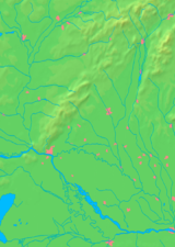
Trnava (Slovak pronunciation: [ˈtr̩naʋa], also known by other alternative names) is a city in western Slovakia, 47 km (29 mi) to the north-east of Bratislava, on the Trnávka river. It is the capital of a kraj (Trnava Region) and of an okres (Trnava District). It is the seat of a Roman Catholic archbishopric (1541–1820 and then again since 1977). The city has a historic center. Because of the many churches within its city walls, Trnava has often been called "parva Roma", i.e. "Little Rome", or more recently, the "Slovak Rome".
The name of the city is derived from the Slovak word tŕnie ("thornbush") which characterized the river banks in the region. The Hungarian name (first mentioned in 1238 in the form of Zumbotel) originates from the Hungarian word szombat ("Saturday"), referring to the weekly market fairs held on Saturdays. The varieties of the name in different languages include German: Tyrnau; Hungarian: Nagyszombat and Latin: Tyrnavia.
Permanent settlements on the city's territory are known from the Neolithic period onwards. During the Middle Ages, an important market settlement arose here at the junction of two important roads – from Bohemia to Hungary and from the Mediterranean to Poland.
...
Wikipedia


