Tongariro
| Mount Tongariro | |
|---|---|
 |
|
| Highest point | |
| Elevation | 1,978 m (6,490 ft) |
| Coordinates | 39°08′00″S 175°38′30″E / 39.13333°S 175.64167°ECoordinates: 39°08′00″S 175°38′30″E / 39.13333°S 175.64167°E |
| Geography | |
| Geology | |
| Age of rock | 275,000 Years |
| Mountain type | Complex volcano |
| Volcanic arc/belt | Taupo Volcanic Zone |
| Last eruption | 21st November 2012 13:50 |
| Climbing | |
| Easiest route | Tongariro Alpine Crossing |
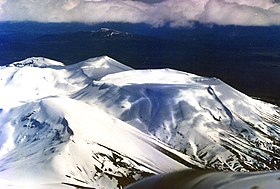
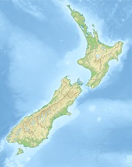
Mount Tongariro (/ˈtɒŋɡəˌrɛ.roʊ/; Māori pronunciation: [tɔŋaɾiɾɔ]) is a compound volcano in the Taupo Volcanic Zone of the North Island of New Zealand. It is located 20 kilometres (12 mi) to the southwest of Lake Taupo, and is the northernmost of the three active volcanoes that dominate the landscape of the central North Island.
Mount Tongariro is part of the Tongariro volcanic centre, which consists of four massifs made of andesite: Tongariro, Kakaramea, Pihanga, and Ruapehu. The andesitic eruptions formed Tongariro, a steep stratovolcano, reaching a height of 1,978 metres (6,490 ft). Tongariro is composed of layers of both lava and tephra and first erupted 275,000 years ago.
Tongariro consists of at least 12 cones. Ngauruhoe, while often regarded as a separate mountain, is geologically a cone of Tongariro. It is also the most active vent, having erupted more than 70 times since 1839, the last episode in 1973 to 1975.
Activity has also been recorded at other vents in recent history. Te Māri Craters erupted in 2012, for the first time since 1897. Red Crater last erupted ash in 1926 and contains active fumaroles. There are many explosion craters on the massif; water has filled some of these to form the Blue Lake and the Emerald Lakes.
...
Wikipedia

