Mount Ruapehu
| Mount Ruapehu | |
|---|---|

Mt Ruapehu from Tongariro Northern Circuit, 2015
|
|
| Highest point | |
| Elevation | 2,797 m (9,177 ft) |
| Prominence | 2,797 m (9,177 ft) |
| Listing |
Ultra New Zealand #19 |
| Coordinates | 39°17′00″S 175°34′00″E / 39.28333°S 175.56667°ECoordinates: 39°17′00″S 175°34′00″E / 39.28333°S 175.56667°E |
| Naming | |
| Translation | pit of noise or exploding pit (Māori) |
| Geography | |
| Geology | |
| Age of rock | ~200,000 years |
| Mountain type | Stratovolcano |
| Volcanic arc/belt | Taupo Volcanic Zone |
| Last eruption | 25 September 2007 |
| Climbing | |
| First ascent | 1879 by G. Beetham and J. P. Maxwell |
| Easiest route | Hike |
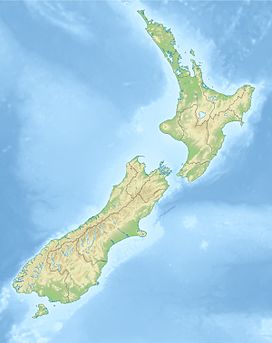
Mount Ruapehu, or just Ruapehu, is an active stratovolcano at the southern end of the Taupo Volcanic Zone in New Zealand. It is 23 kilometres (14 mi) northeast of Ohakune and 23 km (14 mi) southwest of the southern shore of Lake Taupo, within Tongariro National Park. The North Island's major skifields and only glaciers are on its slopes.
Ruapehu, the largest active volcano in New Zealand, is the highest point on the North Island and has three major peaks: Tahurangi (2,797 m), Te Heuheu (2,755 m) and Paretetaitonga (2,751 m). The deep, active crater is between the peaks and fills with a crater lake between major eruptions.
Ruapehu is largely composed of andesite and began erupting at least 250,000 years ago. In recorded history, major eruptions have been about 50 years apart, in 1895, 1945 and 1995–1996. Minor eruptions are frequent, with at least 60 since 1945. Some of the minor eruptions in the 1970s generated small ash falls and lahars (mudflows) that damaged skifields.
Between major eruptions, a warm acidic crater lake forms, fed by melting snow. Major eruptions may completely expel the lake water. Where a major eruption has deposited a tephra dam across the lake's outlet, the dam may collapse after the lake has refilled and risen above the level of its normal outlet, the outrush of water causing a large lahar. In 2000, the ERLAWS system was installed on the mountain to detect such a collapse and alert the relevant authorities.
The 1945 eruption emptied the crater lake and dammed the outlet with tephra. The crater slowly refilled with water, until on 24 December 1953 the tephra dam collapsed causing a lahar in the Whangaehu River. The lahar caused the Tangiwai disaster, with the loss of 151 lives, when the Tangiwai railway bridge across the Whangaehu River collapsed while the lahar was in full flood, just before an express train crossed it.
...
Wikipedia

