Tilla Jogian
| Tilla Jogian Hindu temple complex | |
|---|---|

1st-century BC Tilla Jogian Hindu temple complex
|
|
| Geography | |
| Coordinates | 33°23′59″N 73°17′59″E / 33.3997°N 73.2997°ECoordinates: 33°23′59″N 73°17′59″E / 33.3997°N 73.2997°E |
| Country | Pakistan |
| State | Punjab |
| District | Mandi Bahauddin District, Gujrat District, Jhelum District and Chakwal District |
| Location | Salt Range |
| Culture | |
| Primary deity | Shiva, Surya |
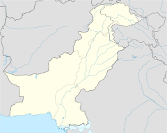
Tilla Jogian (in Punjabi ٹلہ جوگیاںUrdu: ٹلہ جوگیاں), location of Tilla Jogian temple complex - a 1st-century BCHindu and Sikh holy site, is the highest peak in the eastern Salt Range in Punjab, Pakistan.
At 975 meters (3200 ft) above sea level, Tilla Jogian is about 25 km to the west of Jhelum city and 10 km west of the model village of Khukha. The view from the top of Tilla is highly rewarding. Rohtas, Pakistan Fort is located to the east of Tilla Jogian at a distance of about 7 km from Dina, a rapidly expanding town on the Grand Trunk Road.
Tilla Jogian mountain peak can be seen from districts of Mandi Bahauddin, Gujrat, Jhelum and Chakwal. It is situated on a commanding place near the Jhelum River. From its height of 3200 feet, you can see a panorama unparalleled in Pakistan.
Tilla Jogian temple complex has been place of Hindu pilgrimage for at least 2000 years. It was established in 1st century BC by the Guru Gorakhnath of kanphata Jogis. Tilla Jogian in Punjabi means the Hill of Saints. This is where the Kanphata Jogis, who pierced their earlobes and were an order founded by Guru Gorakhnath have left behind a monastery.
...
Wikipedia

