Thungyai Naresuan Wildlife Sanctuary
| Thungyai Naresuan Wildlife Sanctuary | |
|---|---|
| เขตรักษาพันธุ์สัตว์ป่าทุ่งใหญ่นเรศวร | |
|
IUCN category IV (habitat/species management area)
|
|

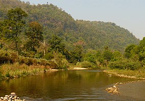
Ramit River at the southern edge of Thungyai Sanctuary bordering Khao Laem National Park
|
|
|
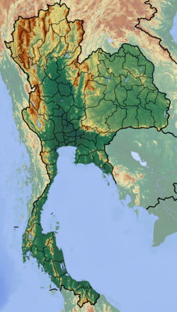
Location in Thailand
|
|
| Location | Kanchanaburi and Tak Provinces |
| Nearest city | Tak (town) |
| Coordinates | 15°20′N 98°55′E / 15.333°N 98.917°ECoordinates: 15°20′N 98°55′E / 15.333°N 98.917°E |
| Area | 3,690 km2 (1,420 sq mi) |
| Established | 1974 |
| Governing body | Wildlife Conservation Office |
| UNESCO World Heritage Site | |
|---|---|
| Location |
Thailand |
| Criteria | vii, ix, x |
| Reference | 591 |
| Coordinates | 15°20′N 98°55′E / 15.33°N 98.92°E |
| Inscription | 1991 (15th Session) |
|
[]
|
|
The Thungyai Naresuan Wildlife Sanctuary (Thai: เขตรักษาพันธุ์สัตว์ป่าทุ่งใหญ่นเรศวร) is a protected area in Thailand in the northern part of Kanchanaburi Province and the southern part of Tak Province. It was declared a wildlife sanctuary in 1972 and was declared a World Heritage Site by UNESCO in 1991 together with the adjoining Huai Kha Khaeng Wildlife Sanctuary.
The sanctuary is at the western national border of Thailand with Burma, in the southern area of the Dawna Range. It extends northeast of the Three Pagodas Pass from Sangkhla Buri District (Kanchanaburi Province) into Umphang District (Tak Province).
The wildlife sanctuary stretches over an area of about 369,000 ha and is the largest protected area in Thailand. Together with the adjoining Huai Kha Khaeng Wildlife Sanctuary (Thai: เขตรักษาพันธุ์สัตว์ป่าห้วยขาแข้ง) it constitutes the core area of the western forest complex which represents the largest agglomeration of contiguous protected area in mainland Southeast Asia, 622,200 ha.
The area is predominantly mountainous and composed of various limestones interspersed with massive intrusions of granite and smaller outcrops of quartzite and schist. Elevations range from about 180 metres at the Vajiralongkorn Reservoir in the south of the sanctuary to its highest peak, Khao Tai Pa, at 1,811 metres. Major rivers are the Mae Klong and the Mae Chan which originate in the Umphang Wildlife Sanctuary and join in Thungyai into the Upper Khwae Yai which feeds the Si Nakharin Reservoir. Various smaller rivers in the south and southwest feed the Vajiralongkorn Reservoir while in the northwestern part of the sanctuary the Mae Kasat and the Mae Suriya flow into Burma.
...
Wikipedia


