Tak Province
|
Tak ตาก |
||
|---|---|---|
| Province | ||
 |
||
|
||
 Map of Thailand highlighting Tak Province |
||
| Country |
|
|
| Capital | Tak | |
| Government | ||
| • Governor | Charoenrit Sa-nguansat (since 2016) | |
| Area | ||
| • Total | 16,406.6 km2 (6,334.6 sq mi) | |
| Area rank | Ranked 4th | |
| Population (2014) | ||
| • Total | 539,553 | |
| • Rank | Ranked 49th | |
| • Density | 33/km2 (85/sq mi) | |
| • Density rank | Ranked 75th | |
| Time zone | ICT (UTC+7) | |
| ISO 3166 code | TH-63 | |
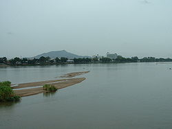
Tak (Thai: ตาก, pronounced [tàːk]) is one of the western provinces (changwat) of Thailand. Neighbouring provinces are (from north clockwise) Mae Hong Son, Chiang Mai, Lamphun, Lampang, Sukhothai, Kamphaeng Phet, Nakhon Sawan, Uthai Thani and Kanchanaburi. The western edge of the province has a long boundary with Kayin State of Myanmar (Burma).
The Bhumibol Dam (named after King Bhumibol Adulyadej, the old name was Yanhee Dam) is in Khao Kaew Tambon (sub-district), Amphoe Sam Ngao (district) of Tak and was built from 1958 to 1964. It stops the river Ping, one of the two sources of the Chao Phraya River. The artificial lake created covers an area of 300 km² and is the largest in Thailand. Taksin Maharat National Park, Namtok Pha Charoen National Park, Lan Sang National Park, and Khun Phawo National Parks are all in the province. Thungyai Naresuan Wildlife Sanctuary share half of the lake front with Kanchanaburi and Huai Kha Khaeng Wildlife Sanctuary at the border with Uthai Thani and are World Heritage Sites.
...
Wikipedia

