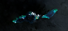
Thitu Island
| Disputed island Other names: Pag-asa |
|
|---|---|

Thitu Island
|
|
| Geography | |
| Location | South China Sea |
| Coordinates | 11°03′N 114°17′E / 11.050°N 114.283°ECoordinates: 11°03′N 114°17′E / 11.050°N 114.283°E |
| Archipelago | Spratly Islands |
| Administered by | |
| Philippines | |
| Municipality | Kalayaan, Palawan |
| Claimed by | |
| People's Republic of China | |
| Philippines | |
| Republic of China (Taiwan) | |
| Vietnam | |
| Demographics | |
| Population | 222 |
Thitu Island (Tagalog: Pag-asa, literally "hope"; simplified Chinese: 中业岛; traditional Chinese: 中業島; pinyin: Zhōngyè Dǎo; Vietnamese: Đảo Thị Tứ; Pangasinan: Ilalo), having an area of 37.2 hectares (92 acres), is the second largest of the naturally occurringSpratly Islands and the largest of the Philippine-administered naturally occurring Spratly Islands. It lies about 480 kilometres (300 mi) west of Puerto Princesa City. Its neighbours are the North Danger Reef to the north, Subi Reef to the west, and the Loaita and Tizard Banks to the south.
Though administered as part of Kalayaan, Palawan, Philippines, it is also claimed by China, Taiwan and Vietnam.
Chinese fishermen historically called the island Tie Zhi (铁峙; 鐵峙; Min dialect pronounced IPA: [T’iɁTu]). It is sometimes incorrectly referred to as "Tiezhi Island" (铁峙岛; 鐵峙島; Tiezhi Dao);Tiezhi Reef (铁峙礁; 鐵寺礁) refers to another area 7.5 km northeast of this island. The modern Chinese name of the island was taken from one of the battleships named Chung-yeh (中業號; Zhongye Hao), sent by the Chinese government during the Republic of China era to regain control of the island in 1946.
...
Wikipedia

