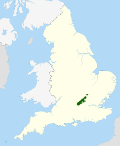
The Chilterns
| Chiltern Hills | |
|---|---|

Chiltern Hills near Nettlebed
|
|
| Highest point | |
| Peak | Haddington Hill |
| Elevation | 267 m (876 ft) |
| Dimensions | |
| Length | 74 km (46 mi) |
| Width | 18 km (11 mi) |
| Area | 833 km2 (322 sq mi) |
| Geography | |
| Location | South East England |
| Country | England |
| Counties |
Bedfordshire Buckinghamshire Hertfordshire Oxfordshire |
| Range coordinates | 51°40′N 0°55′W / 51.667°N 0.917°WCoordinates: 51°40′N 0°55′W / 51.667°N 0.917°W |
| Geology | |
| Type of rock | chalk downland |
The Chiltern Hills form a chalk escarpment in South East England. They are known locally as "the Chilterns". A large portion of the hills was designated officially as an Area of Outstanding Natural Beauty in 1965.
The Chilterns cover an area of 833 km2 (322 sq mi). They are 18 km (11 mi) wide at their widest, and stretch 74 km (46 mi) in a south west to north east diagonal from Goring-on-Thames in Oxfordshire, through Buckinghamshire, via Dunstable Downs and Deacon Hill in Bedfordshire, to near Hitchin in Hertfordshire.
The boundary of the hills is clearly defined on the north west side by the scarp slope. The dip slope is by definition more gradual, and merges with the landscape to the south east. The Thames is a clear end point to the south west, whereas north east of Luton the hills decline slowly in prominence.
The chalk escarpment of the Chiltern Hills overlooks the Vale of Aylesbury, and roughly coincides with the southernmost extent of the ice sheet during the Anglian glacial maximum. The Chilterns are part of a system of chalk downlands throughout eastern and southern England, formed between 65 and 95 million years ago, comprising rocks of the Chalk Group; this also includes Salisbury Plain, Cranborne Chase, the Isle of Wight and the South Downs in the south. In the north, the chalk formations continue northeastwards across north Hertfordshire, Norfolk and the Lincolnshire Wolds, finally ending as the Yorkshire Wolds in a prominent escarpment, south of the Vale of Pickering. The beds of the Chalk Group were deposited over the buried northwestern margin of the Anglo-Brabant Massif during the Upper Cretaceous. During this time, sources for siliciclastic sediment had been eliminated due to the exceptionally high sea level. The formation is thinner through the Chiltern Hills than the chalk strata to the north and south and deposition was tectonically controlled, with the Lilley Bottom structure playing a significant role at times. The Chalk Group, like the underlying Gault Clay and Upper Greensand, is diachronous.
...
Wikipedia

