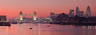
Thames
| Thames | |
| River | |
|
The Thames in London
|
|
| Country | England |
|---|---|
| Counties | Gloucestershire, Wiltshire, Oxfordshire, Berkshire, Buckinghamshire, Surrey, Essex, Kent, Middlesex |
| Towns/Cities | Cricklade, Lechlade, Oxford, Abingdon, Wallingford, Reading, Henley-on-Thames, Marlow, Maidenhead, Windsor, Staines-upon-Thames, Walton-on-Thames, Kingston upon Thames, Teddington, London, Dartford, Gravesend, Southend |
| Source | |
| - location | Thames Head, Gloucestershire, UK |
| - elevation | 110 m (361 ft) |
| - coordinates | 51°41′39″N 2°01′47″W / 51.694262°N 2.029724°W |
| Mouth | Thames Estuary, North Sea |
| - location | Southend-on-Sea, Essex, UK |
| - elevation | 0 m (0 ft) |
| - coordinates | 51°29′56″N 0°36′31″E / 51.4989°N 0.6087°ECoordinates: 51°29′56″N 0°36′31″E / 51.4989°N 0.6087°E |
| Length | 346 km (215 mi) |
| Basin | 12,935 km2 (4,994 sq mi) |
| Discharge | for London |
| - average | 65.8 m3/s (2,324 cu ft/s) |
| Discharge elsewhere (average) | |
| - entering Oxford | 17.6 m3/s (622 cu ft/s) |
| - leaving Oxford | 24.8 m3/s (876 cu ft/s) |
| - Reading | 39.7 m3/s (1,402 cu ft/s) |
| - Windsor | 59.3 m3/s (2,094 cu ft/s) |
|
Map of the Thames within southern England
|
|


