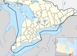
Teeswater River
| Teeswater River | |
| River | |
| Name origin: Named after the River Tees in England | |
| Country | Canada |
|---|---|
| Province | Ontario |
| Region | Southwestern Ontario |
| County | Bruce |
| Municipalities | Arran–Elderslie, Brockton, South Bruce |
| Part of | Great Lakes Basin |
| Source | |
| - location | Bruce County |
| - elevation | 377 m (1,237 ft) |
| - coordinates | 43°58′28″N 81°05′46″W / 43.97444°N 81.09611°W |
| Mouth | Saugeen River |
| - location | Arran–Elderslie |
| - elevation | 214 m (702 ft) |
| - coordinates | 44°18′24″N 81°16′23″W / 44.30667°N 81.27306°WCoordinates: 44°18′24″N 81°16′23″W / 44.30667°N 81.27306°W |
| Length | 75 km (47 mi) |
| Basin | 683 km2 (264 sq mi) |
| Discharge | |
| - average | 11 m3/s (388 cu ft/s) |
| - min | 0.63 m3/s (22 cu ft/s) |
The Teeswater River is a river in the municipalities of Arran–Elderslie, Brockton and South Bruce in Bruce County in Southwestern Ontario, Canada. It is in the Great Lakes Basin and empties into the Saugeen River at Paisley, Ontario.
The community of Teeswater is located on the river.
The river was named after the River Tees in England.
Other map sources:
...
Wikipedia

