Susuman
| Susuman (English) Сусуман (Russian) |
|
|---|---|
| - Town - | |
 View of central Susuman |
|
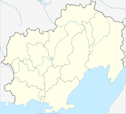
 Location of Magadan Oblast in Russia |
|
|
|
|
|
|
|
|
|
|
| Administrative status (as of November 2012) | |
| Country | Russia |
| Federal subject | Magadan Oblast |
| Administrative district | Susumansky District |
| Administrative center of | Susumansky District |
| Municipal status (as of November 2012) | |
| Municipal district | Susumansky Municipal District |
| Urban settlement | Susuman Urban Settlement |
| Administrative center of | Susumansky Municipal District, Susuman Urban Settlement |
| Statistics | |
| Population (2010 Census) | 5,855 inhabitants |
| Time zone | MAGT (UTC+11:00) |
| Founded | 1936 |
| Town status since | 1964 |
| Postal code(s) | 686314 |
| Dialing code(s) | +7 41345 |
|
|
|
| on | |
Susuman (Russian: Сусума́н) is a town and the administrative center of Susumansky District in Magadan Oblast, Russia, located on the Berelyokh River, 650 kilometers (400 mi) northwest of Magadan, the administrative center of the oblast. Population: 5,855 (2010 Census);7,833 (2002 Census);16,818 (1989 Census).
The town lies in the Kolyma region near where the Susuman River joins the Berelyokh. The town sits on the M56 Kolyma Highway, an unsealed track often known as the "Road of Bones", which connects Yakutsk with Magadan, although it is only passable in winter when the rivers along the route are frozen.
It was founded in 1936 as a settlement of a sovkhoz called Susuman, named after the nearby river of the same name. In 1938, the settlement was greatly expanded to become a center of gold mining in the western part of what is now Magadan Oblast under the control of Dalstroy.
Gold mining and other industrial operations in the region were largely reliant on corrective labor camps of the Gulag system, with a large number operating in Susuman's vicinity. From 1949 until 1956, Susuman was the base for one of the Soviet Union's largest corrective labor camps, the Zaplag of the Dalstroy program. During this time, up to 16,500 prisoners were kept in the camps.
...
Wikipedia


