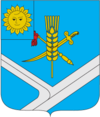
Stara Syniava
|
Stara Syniava Стара Синява |
||
|---|---|---|
| Urban-type settlement | ||
|
||
| Coordinates: 49°35′45″N 27°37′23″E / 49.59583°N 27.62306°ECoordinates: 49°35′45″N 27°37′23″E / 49.59583°N 27.62306°E | ||
| Country |
|
|
| Province |
|
|
| District |
|
|
| Magdeburg law | 1543 | |
| Town status | 1956 | |
| Government | ||
| • Town Chief | Mykola Movchan | |
| Area | ||
| • Total | 0.014 km2 (0.005 sq mi) | |
| Elevation | 294 m (965 ft) | |
| Population (2012) | ||
| • Total |
|
|
| Time zone | EET (UTC+2) | |
| • Summer (DST) | EEST (UTC+3) | |
| Postal code | 31400 | |
| Area code | +380 3850 | |
| Website | http://rada.gov.ua/ | |
Stara Syniava (Ukrainian: Стара Синява) is an urban-type settlement in Khmelnytskyi Oblast (province) in western Ukraine. Stara Syniava also serves as the administrative center of the Stara Syniava Raion (district), housing the raion's local administration buildings. The town's population was 5,961 as of the 2001 Ukrainian Census and 5,581 in 2011.
The settlement, previously named Syniava, received the Magdeburg rights in 1543. In 1956, the town received the status of an urban-type settlement.
Stara Syniava had a large Jewish population for nearly 300 years, having been given the status of shtetl. Starting in the late 1970s and into the 2000s, most of Stara Syniava's Jewish population emigrated from the former USSR and Russia, mostly to the U.S, Canada, and Israel.
...
Wikipedia

