Stanislaus County
| Stanislaus County, California | |||||
|---|---|---|---|---|---|
| County | |||||
| County of Stanislaus | |||||
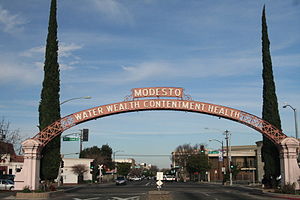
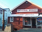
Images, from top down, left to right: Modesto Arch, Knights Ferry's General Store, a view of the Tuolumne River from Waterford
|
|||||
|
|||||
| Motto: "Striving to be the best!" | |||||
 Location in the state of California |
|||||
 California's location in the United States |
|||||
| Country |
|
||||
| State |
|
||||
| Region | San Joaquin Valley | ||||
| Incorporated | April 1, 1854 | ||||
| Named for | Estanislao | ||||
| County seat | Modesto | ||||
| Largest city | Modesto (population and area) | ||||
| Area | |||||
| • Total | 1,515 sq mi (3,920 km2) | ||||
| • Land | 1,495 sq mi (3,870 km2) | ||||
| • Water | 20 sq mi (50 km2) | ||||
| Highest elevation | 3,807 ft (1,160 m) | ||||
| Population (April 1, 2010) | |||||
| • Total | 514,453 | ||||
| • Estimate (2015) | 538,388 | ||||
| • Density | 340/sq mi (130/km2) | ||||
| Time zone | Pacific Time Zone (UTC-8) | ||||
| • Summer (DST) | Pacific Daylight Time (UTC-7) | ||||
| Area code | 209 | ||||
| FIPS code | 06-099 | ||||
| GNIS feature ID | 277314 | ||||
| Website | www |
||||
Stanislaus County (/ˈstænᵻslɔːs/ or /ˈstænᵻslɔː/) is a county located in the Central Valley of the U.S. state of California. As of the 2010 census, the population was 514,453. The county seat is Modesto.
Stanislaus County comprises the Modesto Metropolitan Statistical Area.
The first European to see it was Gabriel Moraga in 1806. It was later named Rio Estanislao in honor of Estanislao, a mission-educated renegade Native American chief who led a band of Native Americans in a series of battles against Mexican troops until finally being defeated by General Mariano Vallejo in 1826. Estanislao was his baptismal name, the Spanish version of Stanislaus (Polish: Stanisław), itself the Latin version of the name of an 11th-century Polish Catholic Saint Stanislaus the Martyr.
...
Wikipedia


