St. Clair, Ontario
| St. Clair | |
|---|---|
| Township (lower-tier) | |
| Township of St. Clair | |

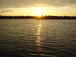
View of St. Clair River from Port Lambton
|
|
| Coordinates: 42°47′N 82°21′W / 42.783°N 82.350°WCoordinates: 42°47′N 82°21′W / 42.783°N 82.350°W | |
| Country |
|
| Province |
|
| County | Lambton |
| Formed | 2001 |
| Government | |
| • Mayor | Steve Arnold |
| • Federal riding | Sarnia—Lambton |
| • Prov. riding | Sarnia—Lambton |
| Area | |
| • Land | 619.32 km2 (239.12 sq mi) |
| Population (2011) | |
| • Total | 14,515 |
| • Density | 23.4/km2 (61/sq mi) |
| Time zone | EST (UTC-5) |
| • Summer (DST) | EDT (UTC-4) |
| Postal Code | N0N & N0P |
| Area code(s) | 519, 226, and 548 |
| Website | www.twp.stclair.on.ca |
St. Clair is a township in southwestern Ontario, Canada, immediately south of Sarnia in Lambton County, along the eastern shores of the St. Clair River.
The township comprises the communities of Avonry, Babys Point, Blecher, Bickford, Bradshaw, Brigden, Charlemont, Colinville, Courtright, Corunna, Cromar, Duthill, Frog Point, Froomfield, Kimball, Ladysmith, Moore Centre, Mooretown, Osborne, Payne, Port Lambton, Port Seckerton, Sombra, Sykeston, Thornyhurst, Vye's Grove, Waubuno, West Becher, Wilkesport.
Corunna
Port Lambton
Sombra
In 1823, Lord Hicks surveyed the town site of Corunna, naming it after the Battle of Corunna in Spain. He chose to name the site after the town A Coruña in Spain because he had spent considerable time there during the Napoleonic Wars. The town's name also owes itself to one of Beresford's commanders, Sir John Moore, who died at the hands of French forces in the Battle of Corunna. Beresford had been sent on a mission to find a suitable capital for a future union between the colonies of Upper Canada (Ontario) and Lower Canada (Quebec). Corunna was not chosen, as it was seen as being too close to the Canada–US border—in the 1820s–1830s, the prospect of an Irish Fenian raid from the United States was considered a serious threat to the British colonies. Today, a small stone cairn stands along Baird Street, near the CSX north-south train track that divides the town. The cairn marks the spot where survey crews planned to build St. George's Square, the area that was to house the Parliament Buildings.
...
Wikipedia

