St. Bernard, Ohio
| St. Bernard, Ohio | |||
|---|---|---|---|
| Village | |||

Nurre-Royston House, built 1859
|
|||
|
|||
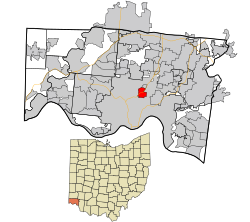
 Location in Hamilton County and the state of Ohio. |
|||
 Detailed map of St. Bernard |
|||
| Coordinates: 39°10′4″N 84°29′42″W / 39.16778°N 84.49500°WCoordinates: 39°10′4″N 84°29′42″W / 39.16778°N 84.49500°W | |||
| Country | United States | ||
| State | Ohio | ||
| County | Hamilton | ||
| Area | |||
| • Total | 1.56 sq mi (4.04 km2) | ||
| • Land | 1.55 sq mi (4.01 km2) | ||
| • Water | 0.01 sq mi (0.03 km2) | ||
| Elevation | 558 ft (170 m) | ||
| Population (2010) | |||
| • Total | 4,368 | ||
| • Estimate (2012) | 4,341 | ||
| • Density | 2,818.1/sq mi (1,088.1/km2) | ||
| Time zone | Eastern (EST) (UTC-5) | ||
| • Summer (DST) | EDT (UTC-4) | ||
| FIPS code | 39-69470 | ||
| GNIS feature ID | 1045404 | ||
St. Bernard is a village in Hamilton County, Ohio, United States. The population was 4,368 at the 2010 census.
St. Bernard is located at 39°10′4″N 84°29′42″W / 39.16778°N 84.49500°W (39.167825, -84.495010), and along with Norwood and Elmwood Place, is an enclave surrounded by the city of Cincinnati.
According to the United States Census Bureau, the village has a total area of 1.56 square miles (4.04 km2), of which 1.55 square miles (4.01 km2) is land and 0.01 square miles (0.03 km2) is water.
St. Bernard was laid out in 1851 at the intersection of Main Street (now Vine Street, Cincinnati), the Miami and Erie Canal, and the Cincinnati, Hamilton and Dayton Railway. The town was originally built up chiefly by Germans.
St. Bernard was incorporated as a village in 1878. The oldest non profit social organization resides in St. Bernard - Idle Hour Social Club. State charted in 1913.
As of the census of 2010, there were 4,368 people, 1,869 households, and 1,090 families residing in the village. The population density was 2,818.1 inhabitants per square mile (1,088.1/km2). There were 2,128 housing units at an average density of 1,372.9 per square mile (530.1/km2). The racial makeup of the village was 80.0% White, 15.7% African American, 0.3% Native American, 0.7% Asian, 0.1% Pacific Islander, 0.9% from other races, and 2.3% from two or more races. Hispanic or Latino of any race were 1.9% of the population.
...
Wikipedia


