South Hero, Vermont
| South Hero, Vermont | |
|---|---|
| Town | |

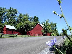
A barn in South Hero
|
|
 Location in Grand Isle County and the state of Vermont |
|
| Location in Grand Isle County and the state of Vermont | |
| Coordinates: 44°38′50″N 73°18′36″W / 44.64722°N 73.31000°WCoordinates: 44°38′50″N 73°18′36″W / 44.64722°N 73.31000°W | |
| Country | United States |
| State | Vermont |
| County | Grand Isle |
| Area | |
| • Total | 47.5 sq mi (123.0 km2) |
| • Land | 14.9 sq mi (38.6 km2) |
| • Water | 32.6 sq mi (84.4 km2) |
| Elevation | 95 ft (29 m) |
| Population (2010) | |
| • Total | 1,631 |
| • Density | 109/sq mi (42.2/km2) |
| Time zone | Eastern (EST) (UTC-5) |
| • Summer (DST) | EDT (UTC-4) |
| ZIP code | 05486 |
| Area code(s) | 802 |
| FIPS code | 50-67000 |
| GNIS feature ID | 1462213 |
| Website | www |
South Hero is a town on Grand Isle in Grand Isle County, Vermont, United States. The population was 1,631 at the 2010 census. It is part of the Lake Champlain Islands chain, along with Grand Isle, North Hero, Alburgh, and Isle La Motte.
The town of South Hero includes the southern half of South Hero Island (also known as Grand Isle), as well as several smaller islands in Lake Champlain, including Providence Island and Stave Island to the southwest. To the west, across Lake Champlain, it is bordered by the towns of Plattsburgh and Peru in Clinton County, New York. To the east, across the eastern arm of Lake Champlain, is the town of Milton in Chittenden County, Vermont, and to the south across the lake is the town of Colchester, also in Chittenden County.
U.S. Route 2 crosses the town, leaving north into the town of Grand Isle and to the east, across Lake Champlain, into a corner of the town of Milton. Burlington, the largest city in Vermont, is 19 miles (31 km) to the south by road, and Rouses Point, New York, is 31 miles (50 km) to the north.
According to the United States Census Bureau, the town of South Hero has a total area of 47.5 square miles (123.0 km2), of which 14.9 square miles (38.6 km2) are land and 32.6 square miles (84.4 km2), or 68.59%, are water.
...
Wikipedia

