Seymour, Indiana
| Seymour, Indiana | |
|---|---|
| City | |
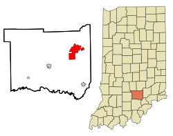
 Location in the state of Indiana |
|
| Coordinates: 38°57′23″N 85°53′24″W / 38.95639°N 85.89000°WCoordinates: 38°57′23″N 85°53′24″W / 38.95639°N 85.89000°W | |
| Country | United States |
| State | Indiana |
| County | Jackson |
| Townships | Jackson, Redding Hamilton |
| Government | |
| • Mayor | Craig A. Luedeman (R) |
| Area | |
| • Total | 11.43 sq mi (29.60 km2) |
| • Land | 11.42 sq mi (29.58 km2) |
| • Water | 0.01 sq mi (0.03 km2) 0.09% |
| Elevation | 604 ft (184 m) |
| Population (2010) | |
| • Total | 17,503 |
| • Estimate (2012) | 18,520 |
| • Density | 1,532.7/sq mi (591.8/km2) |
| Time zone | EST (UTC-5) |
| • Summer (DST) | EDT (UTC-4) |
| ZIP code | 47274 |
| Area code(s) | 812 & 930 |
| FIPS code | 18-68832 |
| GNIS feature ID | 0443233 |
| Website | http://www.seymourcity.com/ |
Seymour is a city in Jackson County, Indiana, United States. The population was 17,503 at the 2010 census. Seymour is called the "Crossroads of America" because the north/south and east/west railroads intersect in downtown.
The north/south line, the Jeffersonville, Madison and Indianapolis Railroad, was built in the 1840s connecting Indianapolis to the Ohio River at Jeffersonville. It ran through the Shields farm at the area that is now Seymour.
In 1852 when the east/west railroad, the Ohio and Mississippi Railroad, was going to be built, Capt. Meedy Shields, who was the cousin of General John Tipton persuaded the surveyor, John Seymour, into putting it through his land, in return for which he named the town Seymour. All trains had to stop at a crossroad, making Seymour a bustling community.
Seymour is the birthplace of singer John Mellencamp, former Indiana 9th District U.S. Representative Baron Hill, Texas lawyer Paul Eggers, Miss America 2009 Katie Stam, retired professional wrestler Rip Rogers, and Robert Shields whose personal diary earned him a place in the Guinness Book of World Records. Robert William Shields was a distant cousin of Seymour founder Meedy Shields.
Seymour is located at 38°57′23″N 85°53′24″W / 38.95639°N 85.89000°W (38.956350, -85.890068).
...
Wikipedia
